

Here you can study for the exam. Look up keywords and learn definitions about all kind of subjects.
More subjects
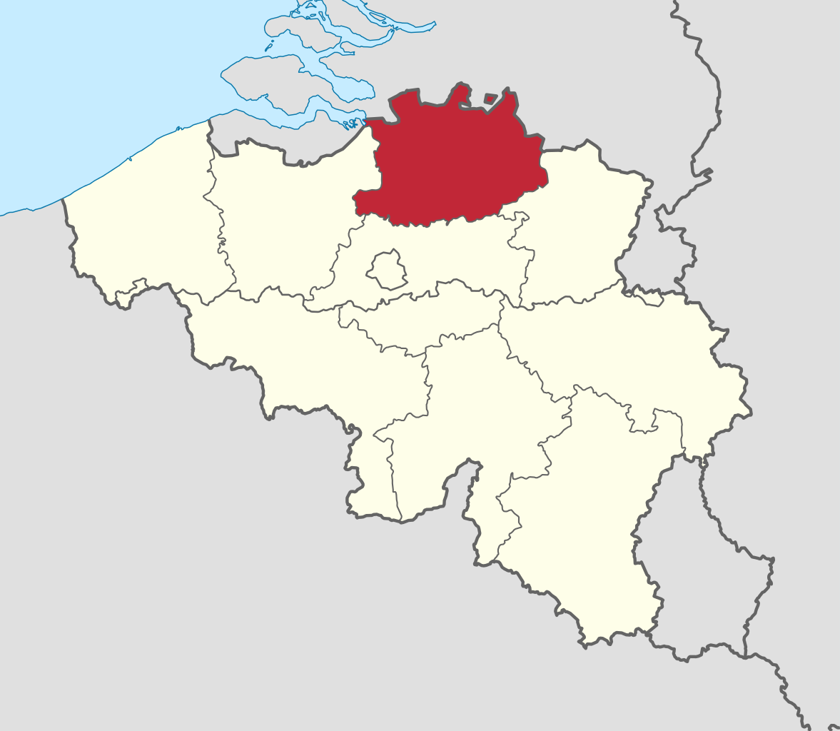
Antwerp Province (Dutch: Provincie Antwerpen [ˈɑntʋɛrpə(n)] , French: Province d'Anvers, German: Provinz Antwerpen), between 1815 and 1830 known as Central Brabant (Dutch: Midden-Brabant, French: Brabant-Central, German: Mittel-Brabant), is the northernmost province both of the Flemish Region, also called Flanders, and of Belgium. It borders on the North Brabant province of the Netherlands to the north and the Belgian provinces of Limburg, Flemish Brabant and East Flanders. Its capital is Antwerp, which includes the Port of Antwerp, the second-largest seaport in Europe. It has an area of 2,876 km2 (1,110 sq mi), and with over 1.85 million inhabitants as of January 2019, is the country's most populous province. The province consists of three arrondissements: Antwerp, Mechelen and Turnhout. The eastern part of the province comprises the main part of the Campine region. (Source: Wikipedia.org, CC BY-SA)
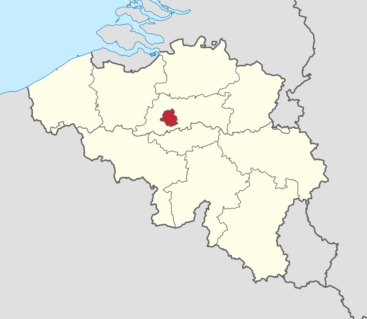
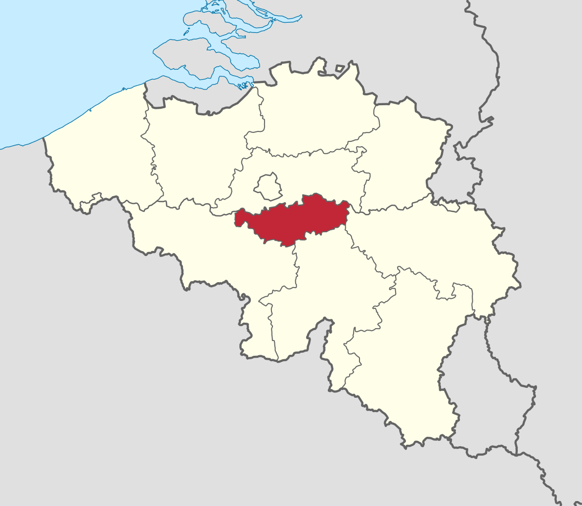
Brussels (French: Bruxelles [bʁysɛl] or [bʁyksɛl] ; Dutch: Brussel [ˈbrʏsəl] ), officially the Brussels-Capital Region (French: Région de Bruxelles-Capitale; Dutch: Brussels Hoofdstedelijk Gewest), is a region of Belgium comprising 19 municipalities, including the City of Brussels, which is the capital of Belgium. The Brussels-Capital Region is located in the central portion of the country and is a part of both the French Community of Belgium and the Flemish Community, but is separate from the Flemish Region (within which it forms an enclave) and the Walloon Region. (Source: Wikipedia.org, CC BY-SA)
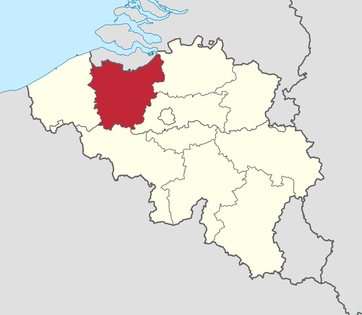
East Flanders (Dutch: Oost-Vlaanderen [ˌoːst ˈflaːndərə(n)] , French: (Province de) Flandre-Orientale [flɑ̃dʁ ɔʁjɑ̃tal], German: Ostflandern [ˈɔstˌflandɐn]) is a province of Belgium. It borders (clockwise from the North) the Dutch province of Zeeland and the Flemish province of Antwerp, Flemish Brabant, Hainaut and West Flanders. It has an area of 3,007 km2 (1,161 sq mi), divided into six administrative districts containing 60 municipalities, and a population of 1,515,064 as of January 2019. The capital is Ghent, home to the Ghent University and the Port of Ghent. (Source: Wikipedia.org, CC BY-SA)
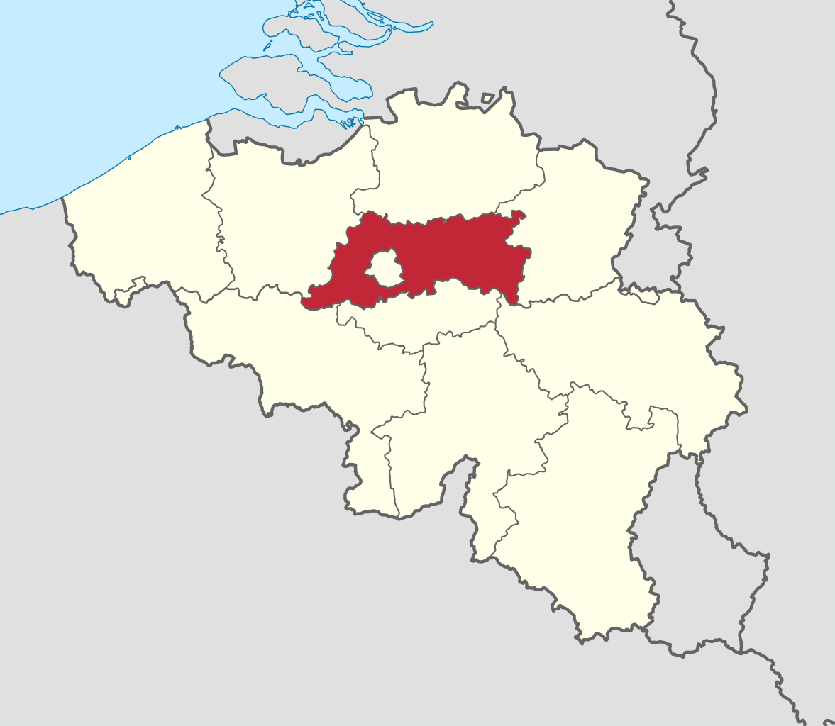
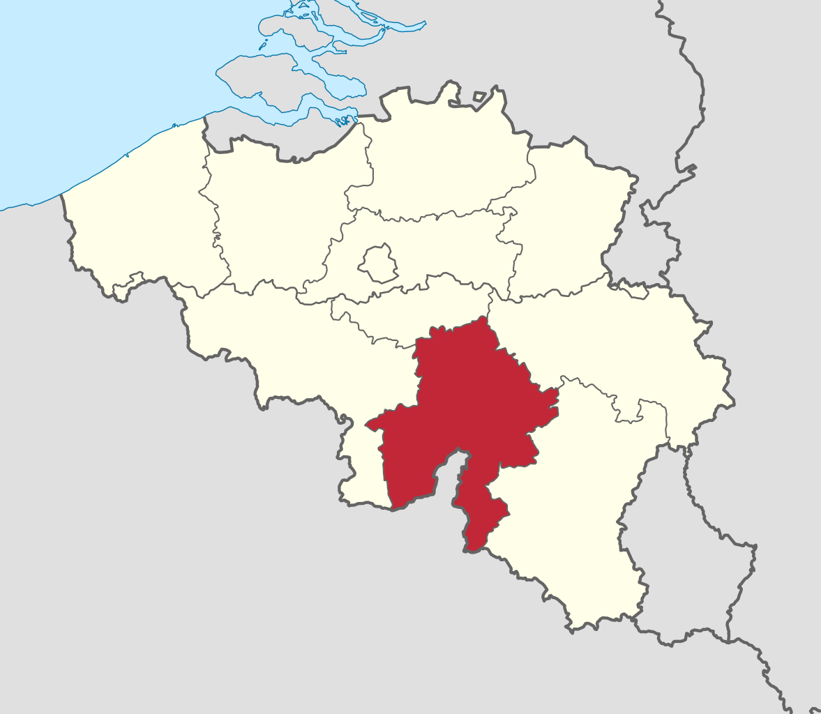
Flemish Brabant (Dutch: Vlaams-Brabant [ˌvlaːmz ˈbraːbɑnt] ; French: Brabant flamand [bʁabɑ̃ flamɑ̃] ) is a province of Flanders, one of the three regions of Belgium. It borders on (clockwise from the North) the Belgian provinces of Antwerp, Limburg, Liège, Walloon Brabant, Hainaut and East Flanders. Flemish Brabant also surrounds the Brussels-Capital Region. Its capital is Leuven. It has an area of 2,118 km2 (818 sq mi) which is divided into two administrative districts (arrondissementen in Dutch) containing 65 municipalities. As of January 2019, Flemish Brabant has a population of 1,146,175. (Source: Wikipedia.org, CC BY-SA)
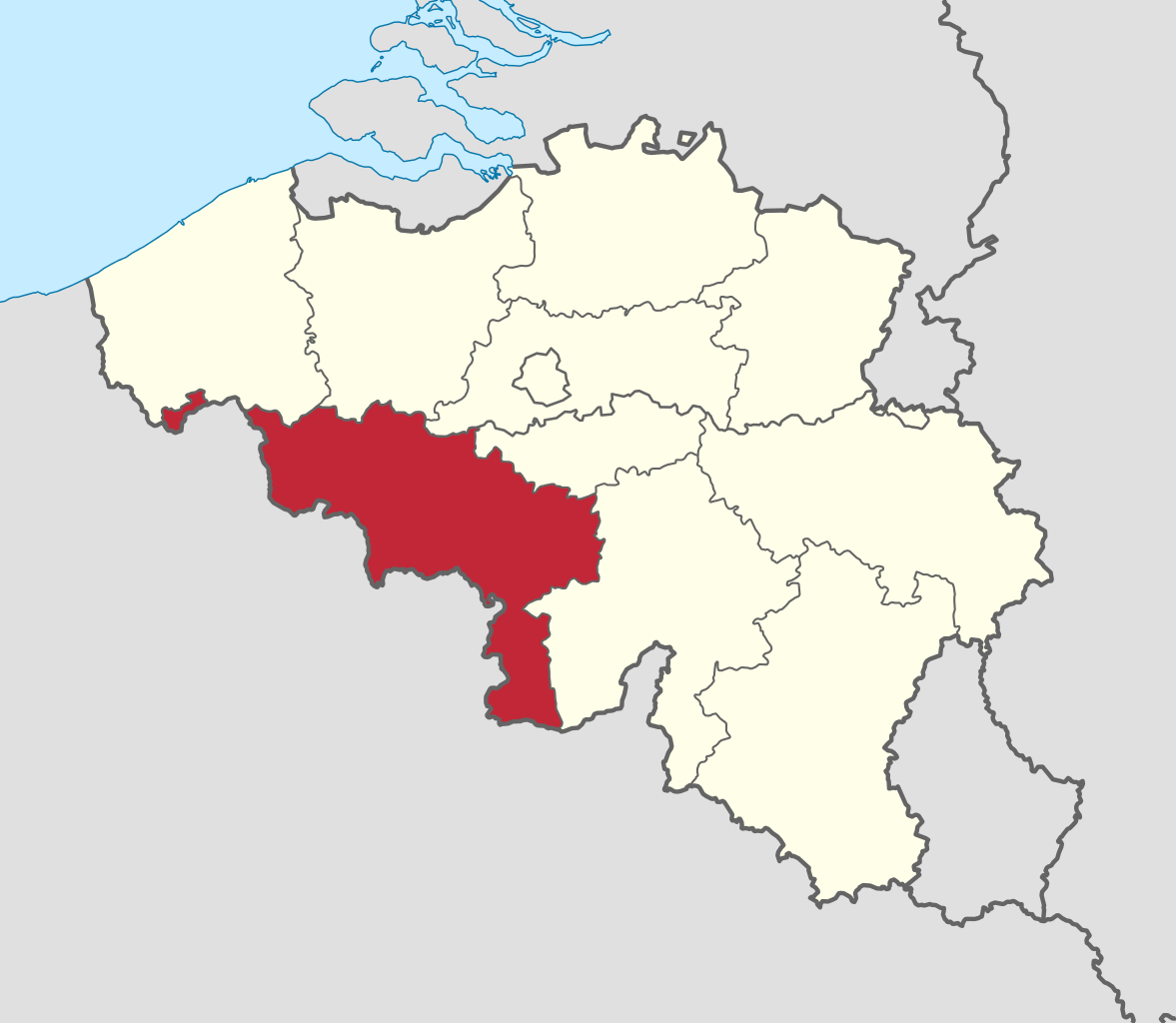
Hainaut (/eɪˈnoʊ/, also US: /heɪˈ-, ɛˈ-/, UK: /ˈ(h)eɪnoʊ/, French: [ɛno]; Dutch: Henegouwen [ˈɦeːnəɣʌuə(n)] ; Walloon: Hinnot; Picard: Hénau), historically also known as Heynowes in English, is a province of Wallonia and Belgium. To its south lies the French department of Nord, while within Belgium it borders (clockwise from the north) on the Flemish provinces of West Flanders, East Flanders, Flemish Brabant and the Walloon provinces of Walloon Brabant and Namur. Its capital is Mons (Dutch: Bergen) and the most populous city is Charleroi, the province's urban, economic and cultural hub, the financial capital of Hainaut and the fifth largest city in the country by population. Hainaut has an area of 3,831 km2 (1,479 sq mi) and as of January 2019 a population of 1,344,241. Another notable city is Tournai (Dutch Doornik) on the Scheldt river, one of the oldest cities in Belgium and the first capital of the Frankish Empire. (Source: Wikipedia.org, CC BY-SA)
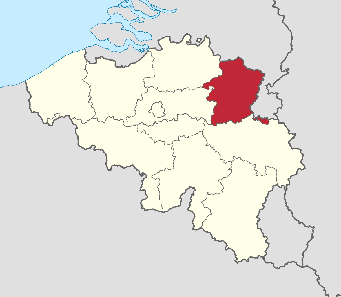
Limburg (Dutch: Limburg, pronounced [ˈlɪmbʏr(ə)x] ; Limburgish: Limburg [ˈlɪm˦ˌbɵʀ˦(ə)ç] or Wes-Limburg [wæsˈlɪm˦ˌbɵʀ˦(ə)ç]; French: Limbourg, pronounced [lɛ̃buʁ] ) is a province in Belgium. It is the easternmost of the five Dutch-speaking provinces that together form the Region of Flanders, one of the three main political and cultural sub-divisions of modern-day Belgium. Limburg is located west of the Meuse (Dutch: Maas), which separates it from the similarly-named Dutch province of Limburg. To the south it shares a border with the French-speaking province of Liège, with which it also has historical ties. To the north and west are the old territories of the Duchy of Brabant. Today these are the Flemish provinces of Flemish Brabant and Antwerp to the west, and the Dutch province of North Brabant to the north. (Source: Wikipedia.org, CC BY-SA)
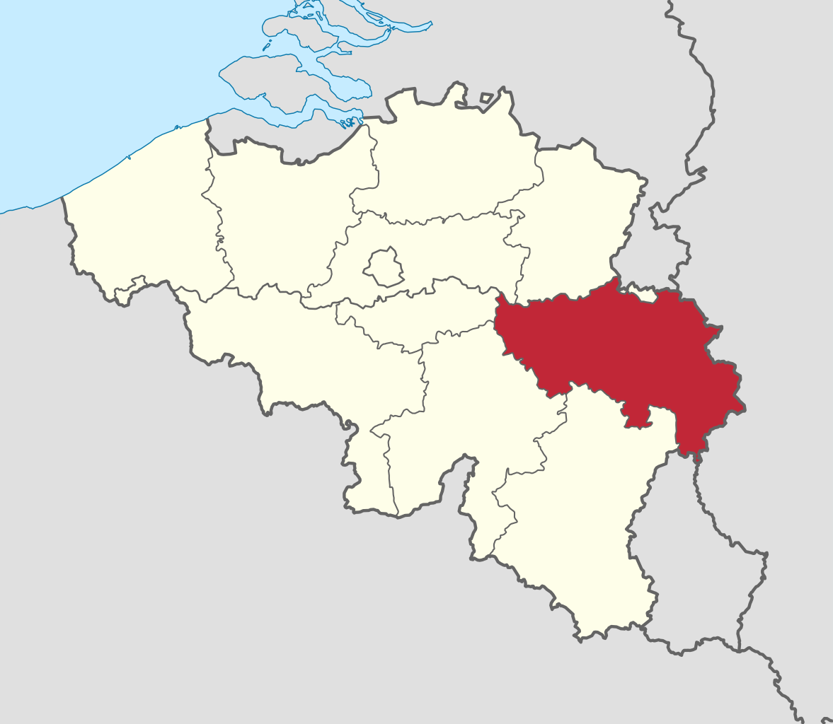
Liège (French: [ljɛʒ] ; Walloon: Lîdje [liːtʃ]; Dutch: Luik [lœyk] ; German: Lüttich [ˈlʏtɪç] ) is the easternmost province of the Wallonia region of Belgium. Liège Province is the only Belgian province that has borders with three countries. It borders (clockwise from the north) the Dutch province of Limburg, the German states of North Rhine-Westphalia and Rhineland-Palatinate, the Luxembourgish canton of Clervaux, the Belgian Walloon (French-speaking) provinces of Luxembourg, Namur and Walloon Brabant and the Belgian Flemish (Dutch-speaking) provinces of Flemish Brabant and Limburg. (Source: Wikipedia.org, CC BY-SA)
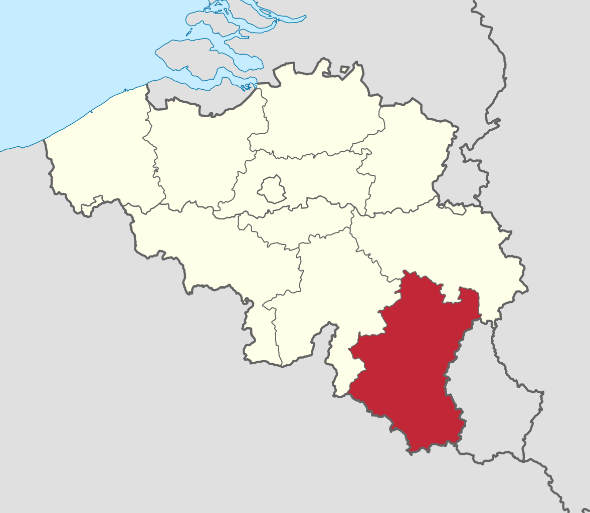
Luxembourg (French: Luxembourg [lyksɑ̃buʁ] ; Dutch: Luxemburg [ˈlyksəmˌbʏr(ə)x] ; German: Luxemburg [ˈlʊksm̩bʊʁk] ; Luxembourgish: Lëtzebuerg [ˈlətsəbuəɕ] ; Walloon: Lussimbork), also called Belgian Luxembourg, is the southernmost province of Wallonia and of Belgium. It borders on the country of Luxembourg to the east, the French departments of Ardennes, Meuse and Meurthe-et-Moselle to the south and southwest, and the Walloon provinces of Namur and Liège to the north. Its capital and largest city is Arlon, in the south-east of the province. It has an area of 4,459 km2 (1,722 sq mi), making it the largest Belgian province. With around 285,000 residents, it is also the least populated province, with a density of 64/km2 (170/sq mi), making it a relatively sparsely settled part of a very densely populated region, as well as the lowest density in Belgium. (Source: Wikipedia.org, CC BY-SA)
Namur (French pronunciation: [namyʁ] ; Dutch: Namen [ˈnaːmə(n)] ; Walloon: Nameur) is a province of Wallonia, one of the three regions of Belgium. It borders (clockwise from the West) on the Walloon provinces of Hainaut, Walloon Brabant, Liège and Luxembourg in Belgium, and the French department of Ardennes. Its capital and largest city is the city of Namur. As of January 2019, the province of Namur has a population of 494,325. (Source: Wikipedia.org, CC BY-SA)
Walloon Brabant (French: Brabant wallon [bʁabɑ̃ walɔ̃] ; Dutch: Waals-Brabant [ˌʋaːlz ˈbraːbɑnt] ; Walloon: Roman Payis) is a province located in Belgium's French-speaking region of Wallonia. It borders on (clockwise from the North) the province of Flemish Brabant (Flemish Region) and the provinces of Liège, Namur and Hainaut. Walloon Brabant's capital and largest city is Wavre. The provincial population was recorded at 403,599 as of January 2019, giving a population density of 368/km2 (950/sq mi). (Source: Wikipedia.org, CC BY-SA)
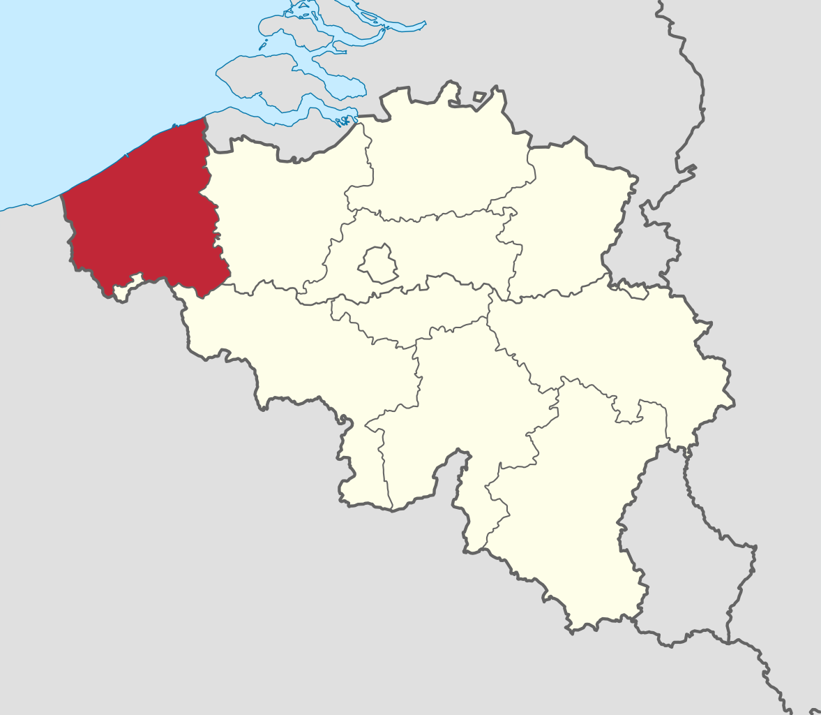
West Flanders (Dutch: West-Vlaanderen [ˌʋɛst ˈflaːndərə(n)] ; West Flemish: West Vloandern; French: (Province de) Flandre-Occidentale [flɑ̃dʁ ɔksidɑ̃tal]; German: Westflandern [ˈvɛstˌflandɐn] ) is the westernmost province of the Flemish Region, in Belgium. It is the only coastal Belgian province, facing the North Sea to the northwest. It has land borders with the Dutch province of Zeeland to the northeast, the Flemish province of East Flanders to the east, the Walloon province of Hainaut in the south and the French department of Nord to the west. Its capital is Bruges (Brugge). Other important cities are Kortrijk in the south and Ostend (Oostende) on the coast, Roeselare and Ypres (Ieper). The province has an area of 3,197 km2 (1,234 sq mi) which is divided into eight administrative districts (arrondissementen) containing 64 municipalities. As of January 2019, West Flanders has a population of 1,195,796. (Source: Wikipedia.org, CC BY-SA)

Time for recess! Post a comment, ask a question or write a review. Feel free to let us know what you think!
The Finnish version is clearly made by a guesser who certainly does not know the road traffic law of Finland. A few mistakes I noticed: 1. The supposed "Road with two-way traffic." sign is in fact "Passing place" and implies a parking restriction. 2. The "Entry prohibited." sign is really "Operation of a vehicle prohibited". It doesn't ban pedestrians from entering or cyclists from pushing their bikes. 3. The "Motorcycles and cars prohibited." sign should be "Operation of a motor vehicle prohibited". Even though not on the sign, every type of motor vehicle, mopeds and tractors for example, is banned. 4 The "Turning left prohibited." sign prohibits not only left turns but also U-turns. This is not mentioned. 5. The "Overtaking prohibited." only applies to overtaking moving motor vehicles other than 2-wheel mopeds and motorcycles without a sidecar that are not in a turning/entry/exit lane. 6. The "Trucks prohibited." is actually "Trucks and vans prohibited." 7. Also, the pictograms are outdated after they were updated in 2020.
This is WRONG... It will specifically be a bus, not a tram. I don't even know how a mandatory sign for trams would work, as they're literally stuck on their rails... They have no choice but to follow their path.
specifically for the British test, there are countless inaccuracies, signs that don't exist in the UK Highways Code, and incorrect explanation of the signage.
I have a small issue with the "manditory lane for buses" sign.... that isn't the sign used, the sign used that I know of shows a bus, the sign here shows SPECIFICALLY a Tram, which is a different vehicle.(the bus used looks like the bus on the bus and tram sign.)
alot of the sighs aren't known or used in my area so I had no clue what they were and had to randomly guest, honestly didn't do to bad. 75/85
 1
1
As a hungarian driver i got 6 wrong. One 2 of them was an idicator light that i never seen in a car (we have older cars) But its a nice test.
2
This sign means that you must be given priority from both sides, not a warning for crossroads
The Czech prohibitory sign with a car and a motorbike separated by a red horizontal line means "All motor vehicles prohibited" not just "Cars and motorbikes prohibited" Also, the prohibitory sign "CLO / ZOLL" (sign B 27 of the Czech traffic code) does not mean access prohibited (checkpoint), but "You're required to stop"
0
Hello, sorry but this is wrong, in Italy motorway (autostrada) has the same sign but is green instead an expressway (that in Italy should be called super-strada) have that sign with blue
0
Dass "Gesenkter Balken" Abblendlicht bedeutet, habe ich nicht gewusst. Ansonsten Danke für die Möglichkeit zu üben.
0
Hey, I appreciate y'all posting the road signs on this website. I plan to study abroad over there in Austria (areas would most likely be Graz, or Vienna) for college, and then still plan so far on wanting to move to Austria or Germany (more so Austria) during or after my study abroad program (With dual citizenship through ancestry with The Czech Republic (assuming it will apply). I just wanted to say thanks for your time making this website possible, and I appreciate this to help me study for a possible driving exam for me (if move to Austria), and every citizen of your country.
I want to get the greek driving license, so should i study from here and thats it for the oral exam ? thanks a lot


More community