

Here you can study for the exam. Look up keywords and learn definitions about all kind of subjects.
More subjects
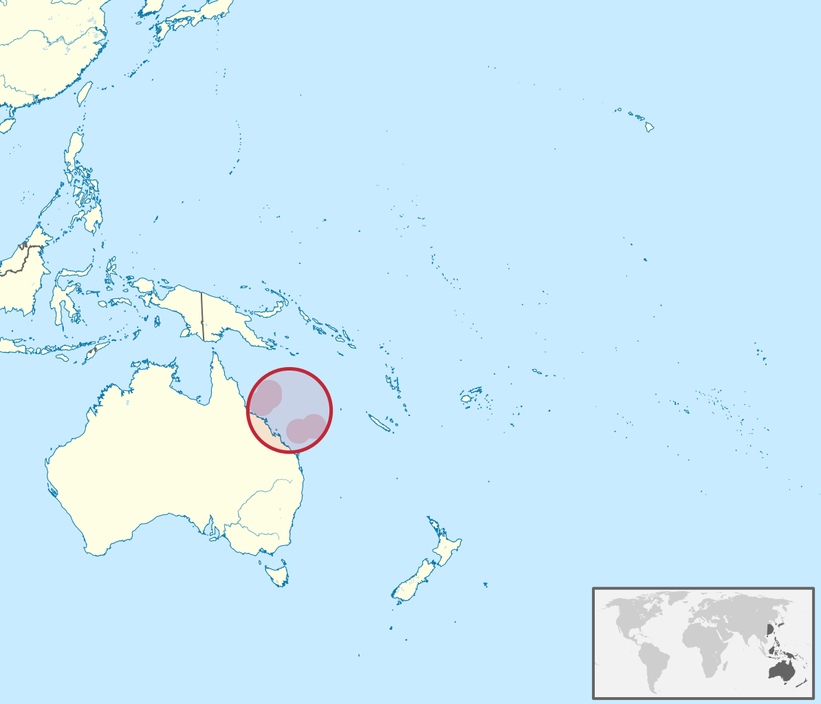
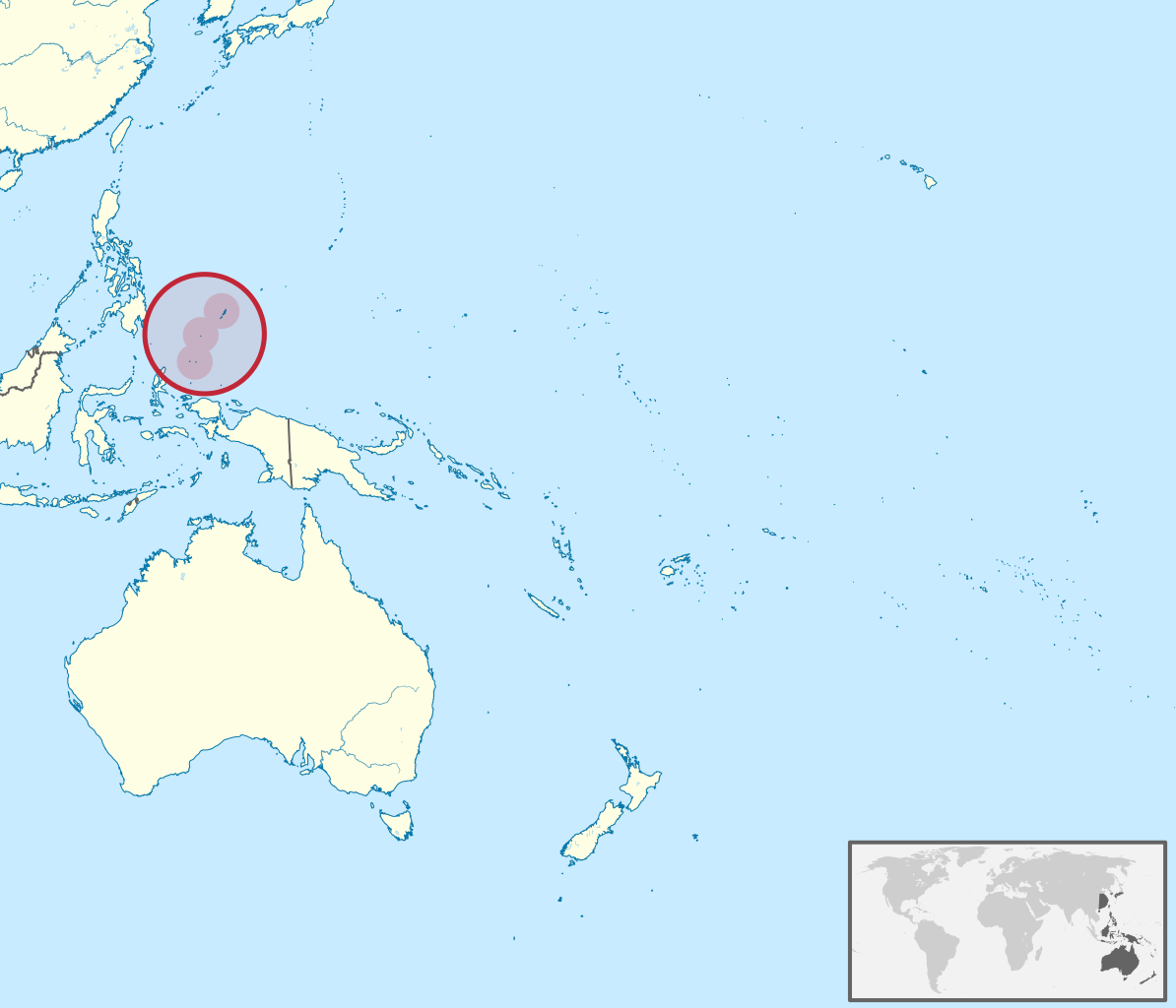
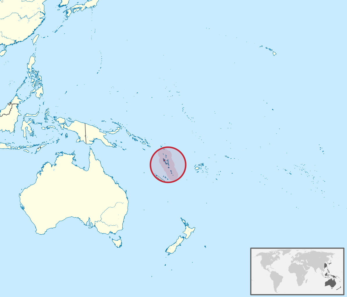
American Samoa (Samoan: Amerika Sāmoa, pronounced [aˈmɛɾika ˈsaːmʊa]; also Amelika Sāmoa or Sāmoa Amelika) is an unincorporated territory of the United States located in the South Pacific Ocean, southeast of the island country of Samoa. Its location is centered on 14.3°S 170.7°W. It is east of the International Date Line, while Samoa is west of the Line. The total land area is 199 square kilometers (76.8 sq mi), slightly more than Washington, D.C. American Samoa is the southernmost territory of the United States and one of two U.S. territories south of the Equator, along with the uninhabited Jarvis Island. Tuna products are the main exports, and the main trading partner is the rest of the United States. American Samoa consists of five main islands and two coral atolls. The largest and most populous island is Tutuila, with the Manuʻa Islands, Rose Atoll and Swains Island also included in the territory. All islands except for Swains Island are part of the Samoan Islands, west of the Cook Islands, north of Tonga, and some 500 kilometres (310 mi) south of Tokelau. To the west are the islands of the Wallis and Futuna group. As of 2022, the population of American Samoa is approximately 45,443 people. Most American Samoans are bilingual and can speak English and Samoan fluently. (Source: Wikipedia.org, CC BY-SA)
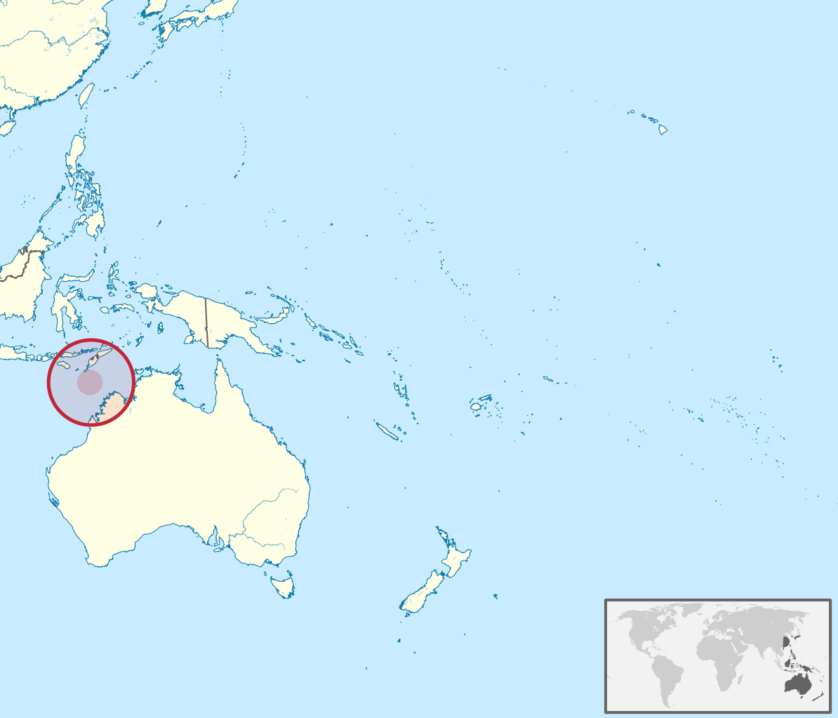
The Territory of Ashmore and Cartier Islands is an uninhabited external territory of Australia consisting of four low-lying tropical islands in two separate reefs, and the 12-nautical-mile (22 km; 14 mi) territorial sea generated by the islands. The territory is located in the Indian Ocean situated on the edge of the continental shelf, about 320 km (199 mi) off the northwest coast of Australia and 144 km (89 mi) south of the Indonesian island of Rote. Ashmore Reef is called Pulau Pasir by Indonesians and Nusa Solokaek in the Rotenese language. Both names have the meaning 'sand island'. The territory comprises Ashmore Reef, which includes West, Middle, and East Islands, and two lagoons, and Cartier Reef, which includes Cartier Island. Ashmore Reef covers approximately 583 km2 (225.1 sq mi) and Cartier Reef 167 km2 (64 sq mi), both measurements extending to the limits of the reefs. West, Middle, and East Islands have a combined land area variously reported as 54 hectares (130 acres), 93 hectares (230 acres) and 112 hectares (280 acres). Cartier Island has a reported land area of 0.4 hectares (0.99 acres). (Source: Wikipedia.org, CC BY-SA)
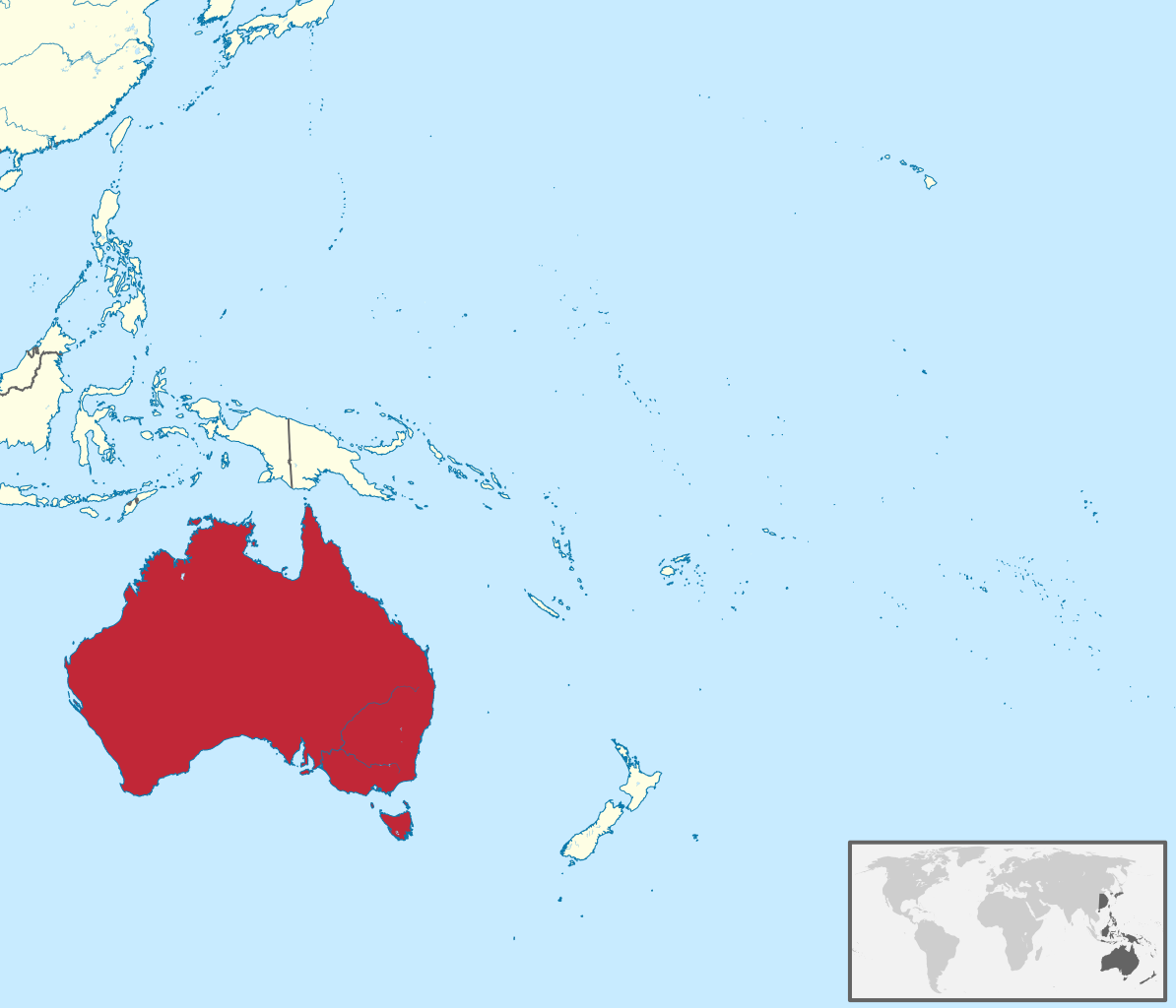
Australia, officially the Commonwealth of Australia, is a sovereign country comprising the mainland of the Australian continent, the island of Tasmania, and numerous smaller islands. With an area of 7,617,930 square kilometres (2,941,300 sq mi), Australia is the largest country by area in Oceania and the world's sixth-largest country. Australia is the oldest, flattest, and driest inhabited continent, with the least fertile soils. It is a megadiverse country, and its size gives it a wide variety of landscapes and climates, with deserts in the centre, tropical rainforests in the north-east, and mountain ranges in the south-east. The ancestors of Aboriginal Australians began arriving from south east Asia approximately 65,000 years ago, during the last ice age. Arriving by sea, they settled the continent and had formed approximately 250 distinct language groups by the time of European settlement, maintaining some of the longest known continuing artistic and religious traditions in the world. Australia's written history commenced with the European maritime exploration of Australia. The Dutch navigator Willem Janszoon was the first known European to reach Australia, in 1606. In 1770, the British explorer James Cook mapped and claimed the east coast of Australia for Great Britain, and the First Fleet of British ships arrived at Sydney in 1788 to establish the penal colony of New South Wales. The European population grew in subsequent decades, and by the end of the 1850s gold rush, most of the continent had been explored by European settlers and an additional five self-governing British colonies established. Democratic parliaments were gradually established through the 19th century, culminating with a vote for the federation of the six colonies and foundation of the Commonwealth of Australia on 1 January 1901. Australia has since maintained a stable liberal democratic political system and wealthy market economy. (Source: Wikipedia.org, CC BY-SA)
Baker Island (previously New Nantucket) is an uninhabited atoll just north of the Equator in the central Pacific Ocean about 3,090 km (1,920 mi) southwest of Honolulu. The island lies almost halfway between Hawaii and Australia. Its nearest neighbor is Howland Island, 42 mi (68 km) to the north-northwest; both have been claimed as territories of the United States since 1857, though the United Kingdom considered them part of the British Empire between 1897 and 1936. The island covers 2.1 km2 (0.81 sq mi), with 4.8 km (3.0 mi) of coastline. The climate is equatorial, with little rainfall, constant wind, and strong sunshine. The terrain is low-lying and sandy: a coral island surrounded by a narrow fringing reef with a depressed central area devoid of a lagoon with its highest point being 8 m (26 ft) above sea level. (Source: Wikipedia.org, CC BY-SA)
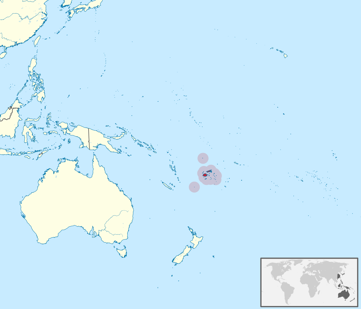
The Cook Islands (Cook Islands Māori: Kūki 'Āirani) is a self-governing island country in the South Pacific Ocean in free association with New Zealand. It comprises 15 islands whose total land area is 240 square kilometres (93 sq mi). The Cook Islands' Exclusive Economic Zone (EEZ) covers 1,960,027 square kilometres (756,771 sq mi) of ocean. Since 2001, the Cook Islands has run its own foreign and defence policy. In recent decades, the Cook Islands have adopted an increasingly assertive foreign policy, and a Cook Islander, Henry Puna, currently serves as Secretary General of the Pacific Islands Forum. Most Cook Islanders are citizens of New Zealand, but they also have the status of Cook Islands nationals, which is not given to other New Zealand citizens. The Cook Islands have been an active member of the Pacific Community since 1980. The Cook Islands' main population centres are on the island of Rarotonga (13,007 in 2016), where there is an international airport. The census of 2016 put the total population at 17,459. There is also a larger population of Cook Islanders in New Zealand and Australia: in the 2018 New Zealand census, 80,532 people said they were Cook Islanders, or of Cook Islands descent. The last Australian census recorded 28,000 Cook Islanders living in Australia, many with Australian citizenship. With over 168,000 visitors travelling to the islands in 2018, tourism is the country's main industry, and the leading element of the economy, ahead of offshore banking, pearls, and marine and fruit exports. (Source: Wikipedia.org, CC BY-SA)
The Coral Sea Islands Territory is an external territory of Australia which comprises a group of small and mostly uninhabited tropical islands and reefs in the Coral Sea, northeast of Queensland, Australia. The only inhabited island is Willis Island. The territory covers 780,000 km2 (301,160 sq mi), most of which is ocean, extending east and south from the outer edge of the Great Barrier Reef and includes Heralds Beacon Island, Osprey Reef, the Willis Group and fifteen other reef/island groups. Cato Island is the highest point in the Territory. (Source: Wikipedia.org, CC BY-SA)
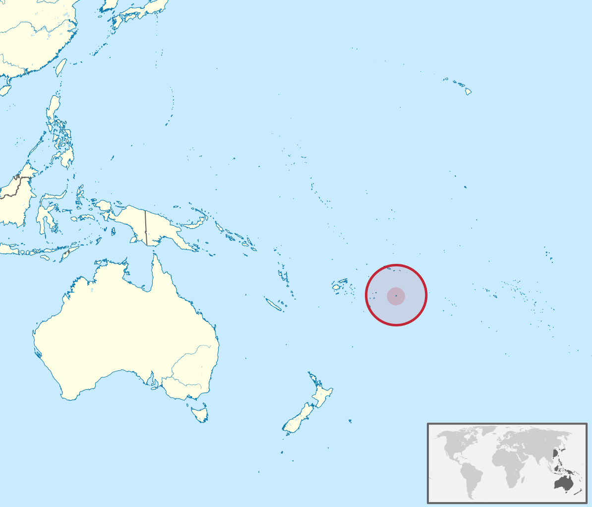
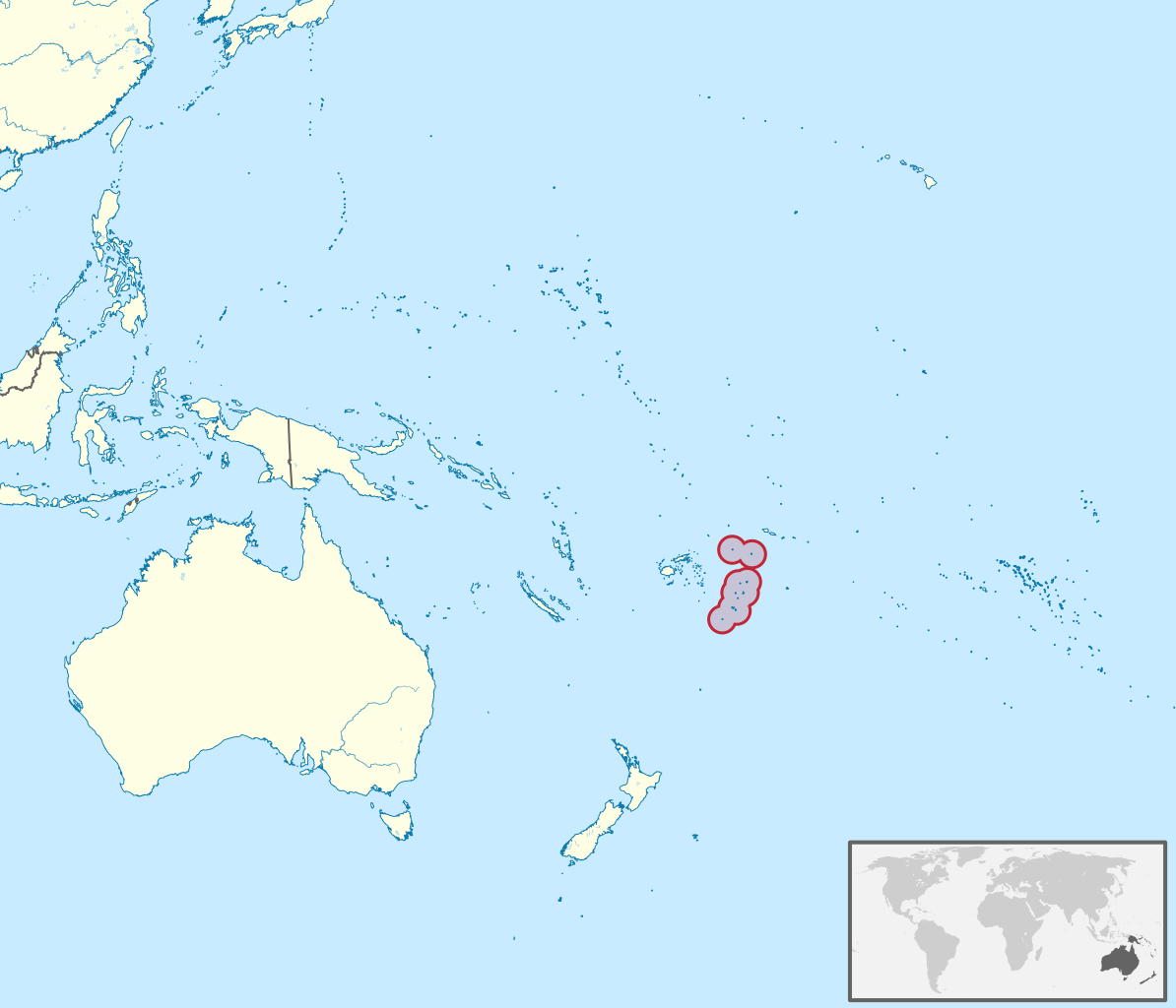
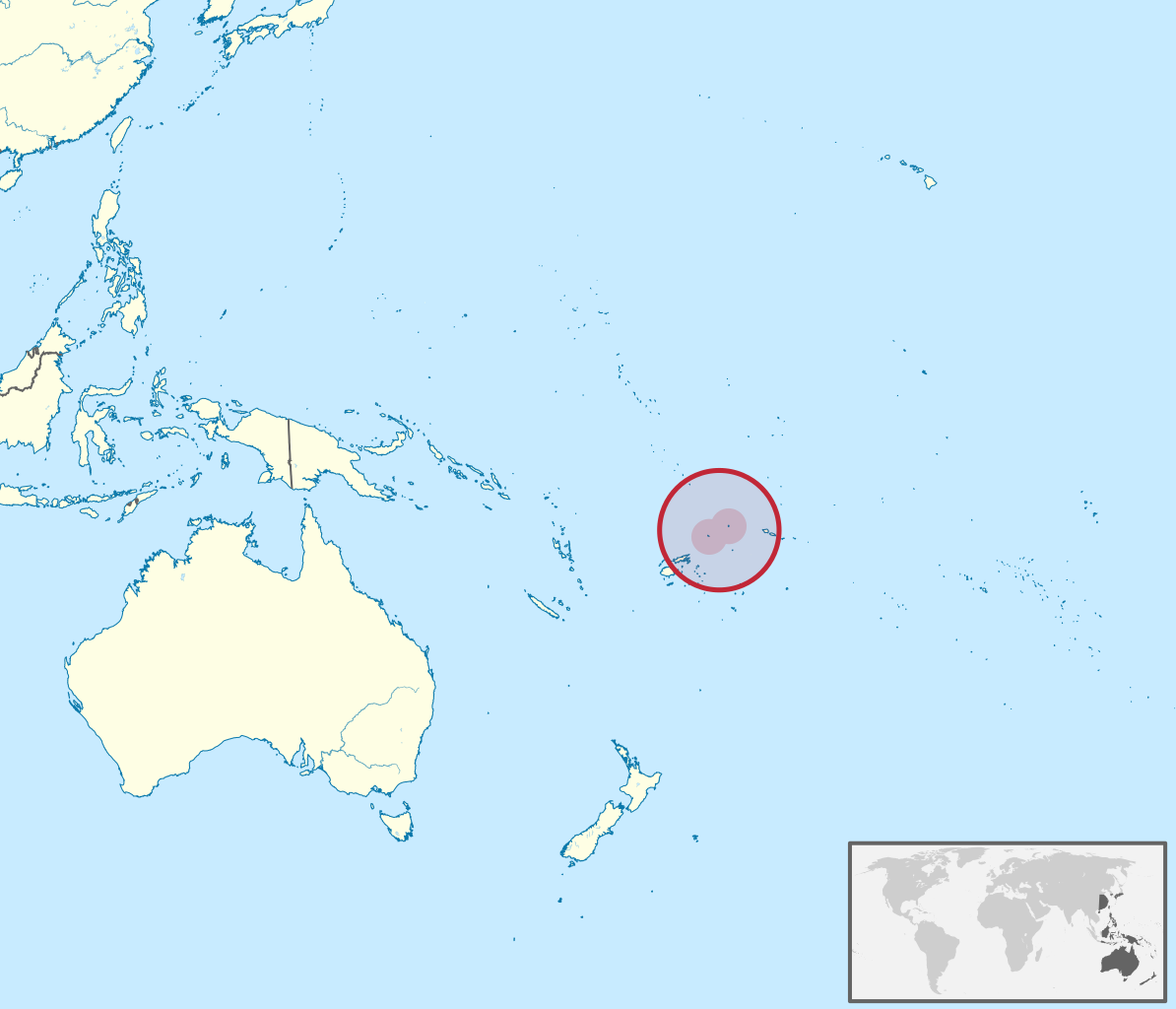
Fiji (/ˈfiːdʒi/ FEE-jee, /fiːˈdʒiː/ fee-JEE,; Fijian: Viti, [ˈβitʃi]; Fiji Hindi: फ़िजी, Fijī), officially the Republic of Fiji, is an island country in Melanesia, part of Oceania in the South Pacific Ocean. It lies about 1,100 nautical miles (2,000 km; 1,300 mi) north-northeast of New Zealand. Fiji consists of an archipelago of more than 330 islands—of which about 110 are permanently inhabited—and more than 500 islets, amounting to a total land area of about 18,300 square kilometres (7,100 sq mi). The most outlying island group is Ono-i-Lau. About 87% of the total population of 924,610 live on the two major islands, Viti Levu and Vanua Levu. About three-quarters of Fijians live on Viti Levu's coasts: either in the capital city of Suva; or in smaller urban centres such as Nadi—where tourism is the major local industry; or in Lautoka, where the sugar-cane industry is dominant. The interior of Viti Levu is sparsely inhabited because of its terrain. The majority of Fiji's islands were formed by volcanic activity starting around 150 million years ago. Some geothermal activity still occurs today on the islands of Vanua Levu and Taveuni. The geothermal systems on Viti Levu are non-volcanic in origin and have low-temperature surface discharges (of between roughly 35 and 60 degrees Celsius (95 and 140 °F)). (Source: Wikipedia.org, CC BY-SA)
French Polynesia (/ˈfrɛntʃ pɒlɪˈniːʒə/ ; French: Polynésie française [pɔlinezi fʁɑ̃sɛz]; Tahitian: Pōrīnetia Farāni) is an overseas collectivity of France and its sole overseas country. It comprises 121 geographically dispersed islands and atolls stretching over more than 2,000 kilometres (1,200 mi) in the South Pacific Ocean. The total land area of French Polynesia is 3,521 square kilometres (1,359 sq mi), with a population of 299,356 (2022 estimate). Among its 121 islands and atolls, 75 were inhabited at the 2017 census. Tahiti, which is in the Society Islands group, is the most populous island, being home to nearly 69% of the population of French Polynesia as of 2017. Papeete, located on Tahiti, is the capital of French Polynesia. Although not an integral part of its territory, Clipperton Island was administered from French Polynesia until 2007. (Source: Wikipedia.org, CC BY-SA)
Guam (/ˈɡwɑːm/ ; Chamorro: Guåhan [ˈɡʷɑhɑn]) is an organized, unincorporated territory of the United States in the Micronesia subregion of the western Pacific Ocean.[better source needed] It is the westernmost point and territory of the United States (reckoned from the geographic center of the U.S.); its capital Hagåtña (144°45'00'E) lies further west than Melbourne, Australia (144°57'47'E). In Oceania, Guam is the largest and southernmost of the Mariana Islands and the largest island in Micronesia. Guam's capital is Hagåtña, and the most populous village is Dededo. People born on Guam are American citizens but have no vote in the United States presidential elections while residing on Guam and Guam delegates to the United States House of Representatives have no vote on the floor. Indigenous Guamanians are the Chamoru, historically known as the Chamorro, who are related to the Austronesian peoples of Indonesia, the Philippines, Malaysia, Taiwan, Micronesia, and Polynesia. As of 2022, Guam's population is 168,801. Chamoros are the largest ethnic group, but a minority on the multi-ethnic island. The territory spans 210 square miles (540 km2; 130,000 acres) and has a population density of 775 per square mile (299/km2). The Chamoro people settled the island approximately 3,500 years ago. Portuguese explorer Ferdinand Magellan, while in the service of Spain, was the first European to visit the island on March 6, 1521. Guam was colonized by Spain in 1668. Between the 16th and 18th centuries, Guam was an important stopover for the Spanish Manila Galleons. During the Spanish–American War, the United States captured Guam on June 21, 1898. Under the Treaty of Paris, signed December 10, 1898, Spain ceded Guam to the U.S. effective April 11, 1899. (Source: Wikipedia.org, CC BY-SA)
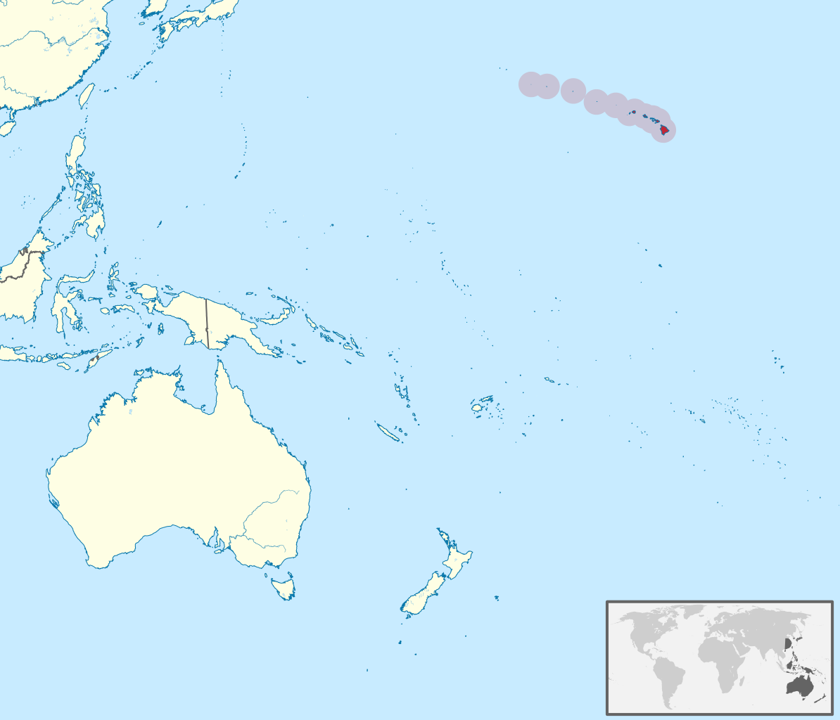
Hawaii (/həˈwaɪi/ hə-WY-ee; Hawaiian: Hawaiʻi [həˈvɐjʔi] or [həˈwɐjʔi]) is a state in the Western United States, located in the Pacific Ocean about 2,000 miles (3,200 km) from the U.S. mainland. It is the only U.S. state outside North America, the only state that is an archipelago, and the only state geographically located within the tropics. Hawaii comprises nearly the entire Hawaiian archipelago, 137 volcanic islands spanning 1,500 miles (2,400 km) that are physiographically and ethnologically part of the Polynesian subregion of Oceania. The state's ocean coastline is consequently the fourth-longest in the U.S., at about 750 miles (1,210 km). The eight main islands, from northwest to southeast, are Niʻihau, Kauaʻi, Oʻahu, Molokaʻi, Lānaʻi, Kahoʻolawe, Maui, and Hawaiʻi—the last of these, after which the state is named, is often called the 'Big Island' or 'Hawaii Island' to avoid confusion with the state or archipelago. The uninhabited Northwestern Hawaiian Islands make up most of the Papahānaumokuākea Marine National Monument, the United States' largest protected area and the fourth-largest in the world. (Source: Wikipedia.org, CC BY-SA)
Howland Island (/ˈhaʊlənd/) is an uninhabited coral island located just north of the equator in the central Pacific Ocean, about 1,700 nautical miles (3,100 km) southwest of Honolulu. The island lies almost halfway between Hawaii and Australia and is an unorganized, unincorporated territory of the United States. Together with Baker Island it forms part of the Phoenix Islands. For statistical purposes, Howland is grouped as one of the United States Minor Outlying Islands. The island has an elongated cucumber-shape on a north–south axis, 1.40 by 0.55 miles (2.25 km × 0.89 km), and covers 1 square mile (640 acres; 2.6 km2). Howland Island National Wildlife Refuge consists of the entire island and the surrounding 32,074 acres (129.80 km2) of submerged land. The island is managed by the U.S. Fish and Wildlife Service as an insular area under the U.S. Department of the Interior and is part of the Pacific Remote Islands Marine National Monument. (Source: Wikipedia.org, CC BY-SA)
Indonesia, officially the Republic of Indonesia, is a country in Southeast Asia and Oceania between the Indian and Pacific oceans. It consists of over 17,000 islands, including Sumatra, Java, Sulawesi, and parts of Borneo and New Guinea. Indonesia is the world's largest archipelagic state and the 14th-largest country by area, at 1,904,569 square kilometres (735,358 square miles). With over 275 million people, Indonesia is the world's fourth-most populous country and the most populous Muslim-majority country. Java, the world's most populous island, is home to more than half of the country's population. Indonesia is a presidential republic with an elected legislature. It has 38 provinces, of which nine have special status. The country's capital, Jakarta, is the world's second-most populous urban area. Indonesia shares land borders with Papua New Guinea, East Timor, and the eastern part of Malaysia, as well as maritime borders with Singapore, Vietnam, Thailand, the Philippines, Australia, Palau, and India (Andaman and Nicobar Islands). Despite its large population and densely populated regions, Indonesia has vast areas of wilderness that support one of the world's highest levels of biodiversity. (Source: Wikipedia.org, CC BY-SA)
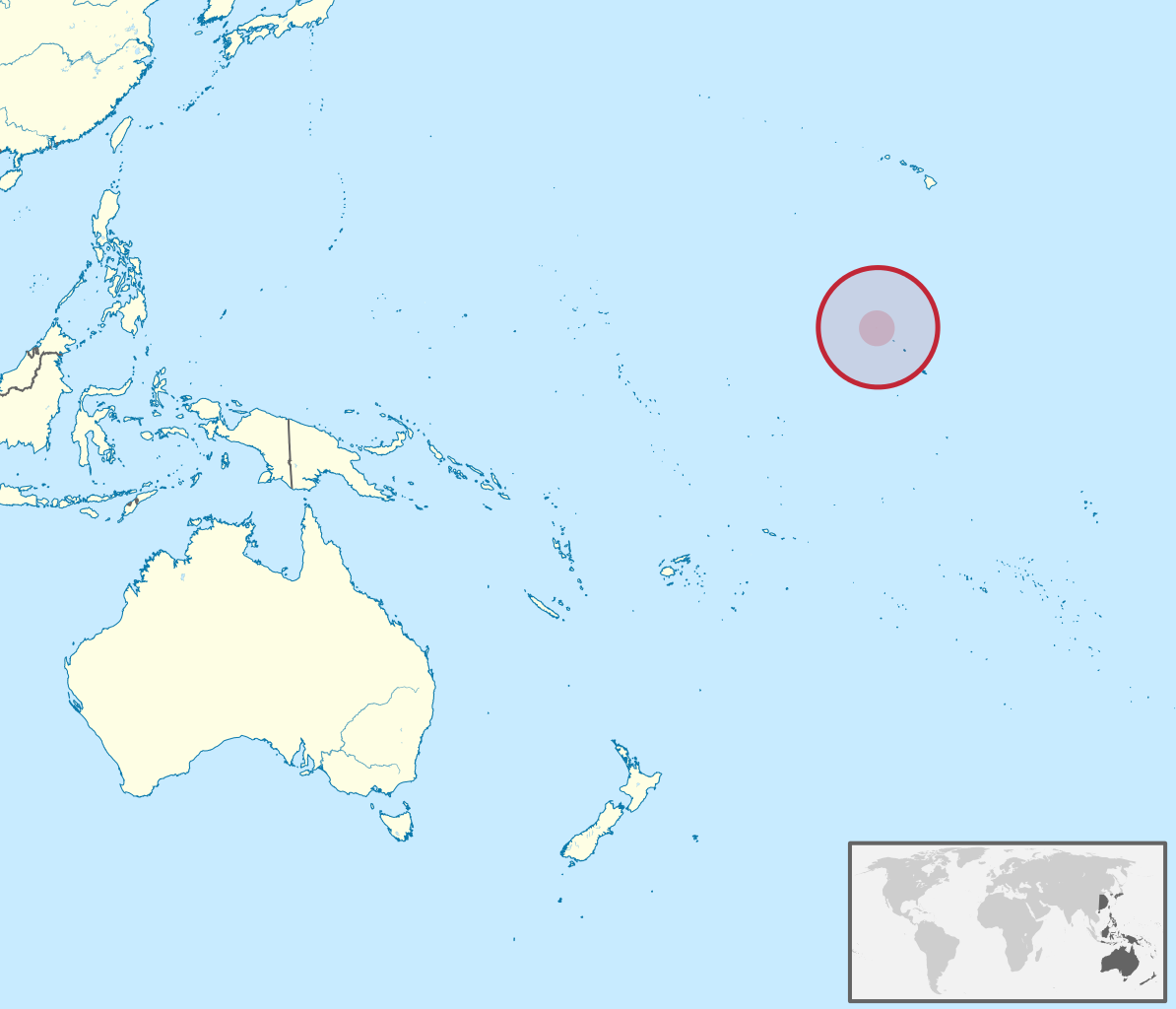
Jarvis Island (/ˈdʒɑːrvɪs/; formerly known as Bunker Island or Bunker's Shoal) is an uninhabited 4.5 km2 (1.7 sq mi) coral island located in the South Pacific Ocean, about halfway between Hawaii and the Cook Islands. It is an unincorporated, unorganized territory of the United States, administered by the United States Fish and Wildlife Service of the United States Department of the Interior as part of the National Wildlife Refuge system. Unlike most coral atolls, the lagoon on Jarvis is wholly dry. Jarvis is one of the Line Islands and for statistical purposes is also grouped as one of the United States Minor Outlying Islands. Jarvis Island is the largest of three U.S. equatorial possessions, which include Baker Island and Howland Island. While a few offshore anchorage spots are marked on maps, Jarvis island has no ports or harbors, and swift currents are a hazard. There is a boat landing area in the middle of the western shoreline near a crumbling day beacon, and another near the southwest corner of the island. The center of Jarvis island is a dried lagoon where deep guano deposits accumulated, which were mined for about 20 years during the nineteenth century. The island has a tropical desert climate, with high daytime temperatures, constant wind, and strong sun. Nights, however, are quite cool. The ground is mostly sandy and reaches 23 feet (7 meters) at its highest point. The low-lying coral island has long been noted as hard to sight from small ships and is surrounded by a narrow fringing reef. (Source: Wikipedia.org, CC BY-SA)
Johnston Atoll is an unincorporated territory of the United States, currently administered by the United States Fish and Wildlife Service (USFWS). Johnston Atoll is a National Wildlife Refuge and part of the Pacific Remote Islands Marine National Monument. It is closed to public entry, and limited access for management needs is only granted by Letter of Authorization from the United States Air Force and a Special Use Permit from the U.S. Fish and Wildlife Service. For nearly 70 years, the isolated atoll was under the control of the U.S. military. During that time, it was variously used as a naval refueling depot, an airbase, a testing site for nuclear and biological weapons, a secret missile base, and a site for the storage and disposal of chemical weapons and Agent Orange. Those activities left the area environmentally contaminated, and monitoring continues. The island is home to thriving communities of nesting seabirds and has significant marine biodiversity. USFWS teams carry out environmental monitoring and maintenance to protect the native wildlife. (Source: Wikipedia.org, CC BY-SA)
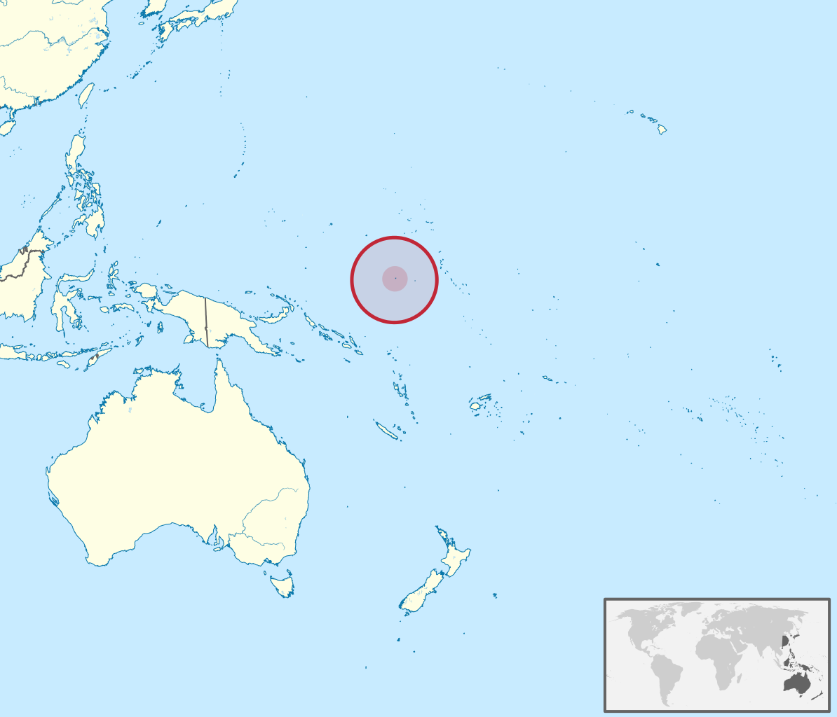
Kingman Reef /ˈkɪŋmən/ is a largely submerged, uninhabited, triangle-shaped reef, geologically an atoll, 9.0 nmi (20 km) east-west and 4.5 nmi (8 km) north-south, in the North Pacific Ocean, roughly halfway between the Hawaiian Islands and American Samoa. It has an area of 3 hectares (0.03 km2; 7.4 acres) and is one of the unincorporated territories of the United States in Oceania. The reef is administered by the United States Fish and Wildlife Service as the Kingman Reef National Wildlife Refuge. It is the northernmost of the Northern Line Islands and lies 36 nautical miles (67 km) northwest of the next closest island (Palmyra Atoll), and 930 nautical miles (1,720 km) south of Honolulu. The reef encloses a lagoon up to 53 fathoms (318 ft; 97 m) deep in its eastern part near the northeastern spit of land. The total area within the outer rim of the reef is 20 sq nmi (70 km2). There are two small strips (spits) of dry land composed of coral rubble and giant clamshells on the eastern rim with areas of 2 and 1 acre (0.8 and 0.4 ha) having a coastline of 2 miles (3 km), a short spit on the northeast side of the lagoon and a spit twice as long but thinner on its south side. The highest point on the reef is less than 5 feet (1.5 m) above sea level, which is wet or awash most of the time, making Kingman Reef a maritime hazard. It has no natural resources and supports no economic activity. (Source: Wikipedia.org, CC BY-SA)
Kiribati (/ˌkɪrɪˈbæs, -ˈbɑːti/), officially the Republic of Kiribati (Gilbertese: [Ribaberiki] Kiribati), is an island country in Oceania in the central Pacific Ocean. The permanent population is over 119,000 (2020), more than half of whom live on Tarawa atoll. The state comprises 32 atolls and one remote raised coral island, Banaba. There is a total land area of 811 square kilometres (313 square miles) dispersed over 3.5 million km2 (1.4 million sq mi) of ocean. Their spread straddles the equator and the 180th meridian, although the International Date Line goes around Kiribati and swings far to the east, almost reaching the 150° W meridian. This brings Kiribati's easternmost islands, the southern Line Islands south of Hawaii, into the same day as the Gilbert Islands and places them in the most advanced time zone on Earth: UTC+14. Kiribati is the only country in the world to be situated in all four cardinal hemispheres. (Source: Wikipedia.org, CC BY-SA)
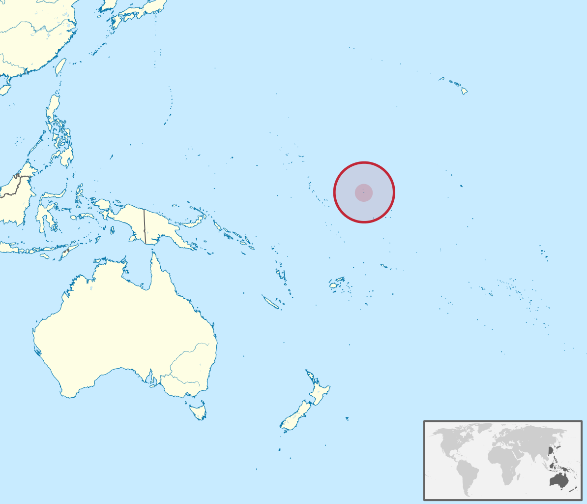
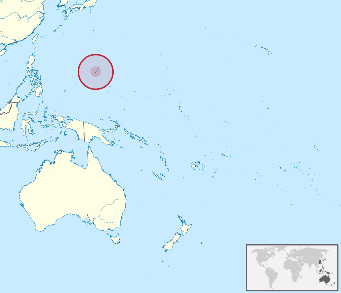
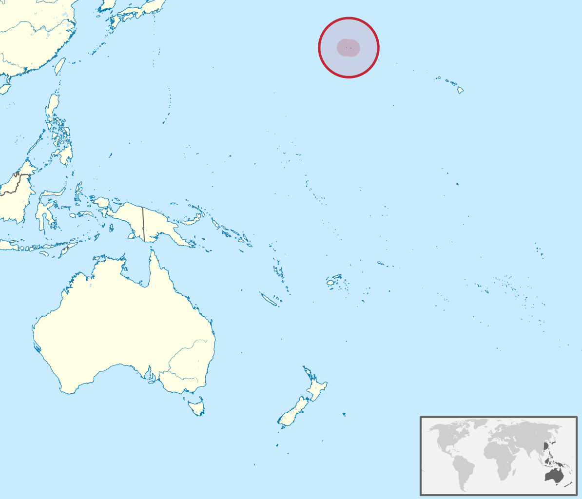
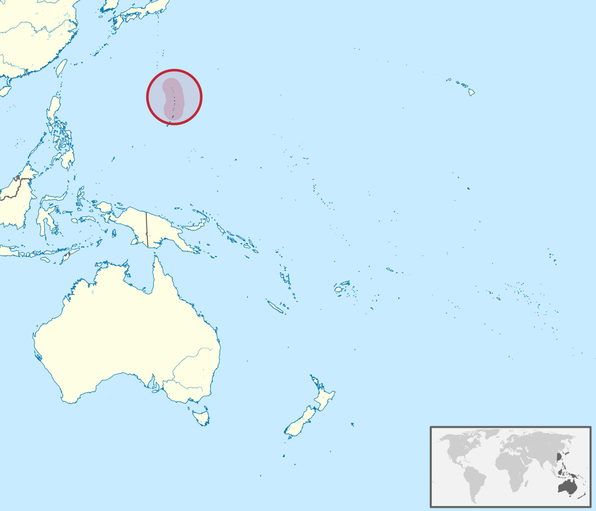
Minamitorishima (南鳥島, lit. 'Southern Bird Island'), also known as Marcus Island, is an isolated Japanese coral atoll in the northwestern Pacific Ocean, located some 1,848 kilometers (1,148 mi) southeast of Tokyo and 1,267 km (787 mi) east of the closest Japanese island, South Iwo Jima of the Ogasawara Islands, and nearly on a straight line between mainland Tokyo and Wake Island, 1,415 km (879 mi) further to the east-southeast. The closest island to Minamitorishima is East Island in the Mariana Islands, which is 1,015 km (631 mi) to the west-southwest. It is the easternmost territory belonging to Japan, and the only Japanese territory on the Pacific Plate, past the Japan Trench. Although small (1.51 km2 (1 sq mi)) it is of strategic importance, as it enables Japan to claim a 428,875 square kilometers (165,589.6 sq mi) exclusive economic zone in the surrounding waters. It is also the easternmost territory of Tokyo, being administratively part of Ogasawara village. There is no civilian population, except personnel of the Japan Meteorological Agency, JSDF, and Japan Coast Guard serving temporary tours of duty on the island. (Source: Wikipedia.org, CC BY-SA)
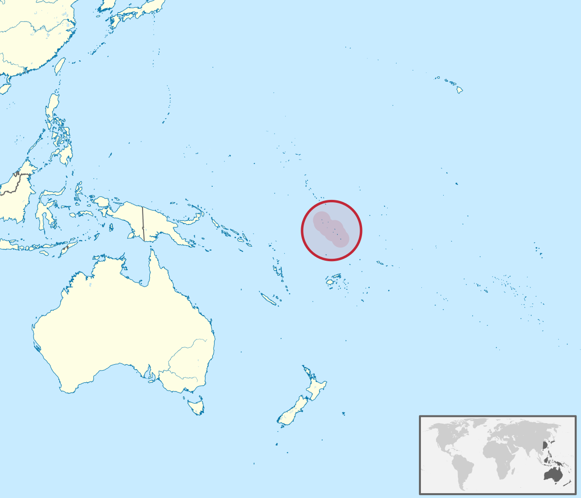
The Marshall Islands (Marshallese: Ṃajeḷ), officially the Republic of the Marshall Islands (Marshallese: Aolepān Aorōkin Ṃajeḷ), is an independent island country and microstate near the Equator in the Pacific Ocean, slightly west of the International Date Line. Geographically, the country is part of the larger island group of Micronesia. The country's population of 58,413 people (at the 2018 World Bank Census) is spread out over five islands and 29 coral atolls, comprising 1,156 individual islands and islets. The capital and largest city is Majuro. It has the largest portion of its territory composed of water of any sovereign state, at 97.87%. The islands share maritime boundaries with Wake Island to the north, Kiribati to the southeast, Nauru to the south, and Federated States of Micronesia to the west. About 52.3% of Marshall Islanders (27,797 at the 2011 Census) live on Majuro. In 2016, 73.3% of the population were defined as being 'urban'. The UN also indicates a population density of 760 inhabitants per square mile (295/km2), and its projected 2020 population is 59,190. (Source: Wikipedia.org, CC BY-SA)
Micronesia (UK: /ˌmaɪkrəˈniːziə/, US: /-ˈniːʒə/) is a subregion of Oceania, consisting of about 2,000 small islands in the western Pacific Ocean. It has a close shared cultural history with three other island regions: the Philippines to the west, Polynesia to the east, and Melanesia to the south—as well as with the wider community of Austronesian peoples. The region has a tropical marine climate and is part of the Oceanian realm. It includes four main archipelagos—the Caroline Islands, the Gilbert Islands, the Mariana Islands, and the Marshall Islands—as well as numerous islands that are not part of any archipelago. Human settlement of Micronesia began several millennia ago. The Micronesian people are considered, by linguistic, archaeological, and human genetic evidence, a subset of the sea-migrating Austronesian people, who include the Polynesian people and the Melanesian people. Based on the current scientific consensus, the Austronesian peoples originated from a prehistoric seaborne migration, known as the Austronesian expansion, from pre-Han Taiwan, at around 3000 to 1500 BCE. Austronesians reached the northernmost Philippines, specifically the Batanes Islands, by around 2200 BCE. Austronesians were the first people to invent oceangoing sailing technologies (notably catamarans, outrigger boats, lashed-lug boat building, and the crab claw sail), which enabled their rapid dispersal into the islands of the Indo-Pacific. From 2000 BCE they assimilated (or were assimilated by) the earlier populations on the islands in their migration pathway. (Source: Wikipedia.org, CC BY-SA)
Midway Atoll (colloquial: Midway Islands; Hawaiian: Kauihelani, lit. 'the backbone of heaven'; Pihemanu, 'the loud din of birds') is a 2.4 sq mi (6.2 km2) atoll in the North Pacific Ocean. Midway Atoll is an insular area of the United States and is an unorganized and unincorporated territory. The largest island is Sand Island, which has housing and an airstrip. Immediately to the east of Sand Island across the narrow Brooks Channel is Eastern Island, which is uninhabited and no longer has any facilities. Forming a rough, incomplete circle around the two main islands and creating Midway Lagoon is Spit Island, a narrow reef. About 40 people live on the atoll, mostly staff of the U.S. Fish and Wildlife Service and contract workers. Visitation to the atoll is possible only for business reasons, which includes permanent and temporary staff, contractors, and volunteers, as the tourism program has been suspended due to budget cutbacks. In 2012, the last year that the visitor program was in operation, 332 people made the trip to Midway. Tours focused on both the unique ecology of Midway, as well as its military history. The economy is derived solely from governmental sources and tourist fees. Nearly all supplies must be brought to the island by ship or plane, although a hydroponic greenhouse and garden supply some fresh fruits and vegetables. (Source: Wikipedia.org, CC BY-SA)
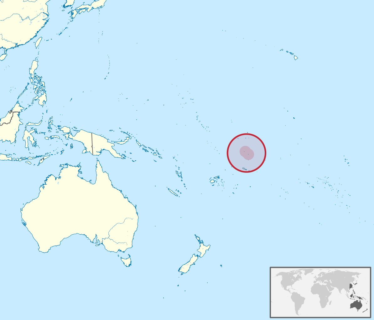
Nauru (/nɑːˈuːruː/ nah-OO-roo or /ˈnaʊruː/ NOW-roo; Nauruan: Naoero), officially the Republic of Nauru (Nauruan: Repubrikin Naoero) and formerly known as Pleasant Island, is an island country and microstate in Oceania, in the Central Pacific. Its nearest neighbour is Banaba Island in Kiribati, about 300 km (190 mi) to the east. It further lies northwest of Tuvalu, 1,300 km (810 mi) northeast of Solomon Islands, east-northeast of Papua New Guinea, southeast of the Federated States of Micronesia and south of the Marshall Islands. With only a 21 km2 (8.1 sq mi) area, Nauru is the third-smallest country in the world behind Vatican City and Monaco, making it the smallest republic as well as the smallest island nation. Its population of about 10,000 is the world's second-smallest (not including colonies or overseas territories), after Vatican City. Settled by people from Micronesia circa 1000 BCE, Nauru was annexed and claimed as a colony by the German Empire in the late 19th century. After World War I, Nauru became a League of Nations mandate administered by Australia, New Zealand, and the United Kingdom. During World War II, Nauru was occupied by Japanese troops, and was bypassed by the Allied advance across the Pacific. After the war ended, the country entered into United Nations trusteeship. Nauru gained its independence in 1968, and became a member of the Pacific Community (PC) in 1969. (Source: Wikipedia.org, CC BY-SA)
New Caledonia (/ˌkælɪˈdoʊniə/; French: Nouvelle-Calédonie) is a sui generis collectivity of overseas France in the southwest Pacific Ocean, south of Vanuatu, about 1,210 km (750 mi) east of Australia, and 17,000 km (11,000 mi) from Metropolitan France. The archipelago, part of the Melanesia subregion, includes the main island of Grande Terre, the Loyalty Islands, the Chesterfield Islands, the Belep archipelago, the Isle of Pines, and a few remote islets. The Chesterfield Islands are in the Coral Sea. French people, especially locals, call Grande Terre 'Le Caillou' ('the pebble'). New Caledonia has a land area of 18,576 km2 (7,172 sq mi) divided into three provinces. The North and South Provinces are on the New Caledonian mainland, while the Loyalty Islands Province is a series of three islands off the east coast of mainland. New Caledonia's population of 271,407 (October 2019 census) is of diverse origins and varies by geography; in the North and Loyalty Islands Provinces, the indigenous Kanak people predominate, while the wealthy South Province contains significant populations of European (Caldoches and Metropolitan French), Kanak, and Polynesian (mostly Wallisian) origin, as well as smaller groups of Southeast Asian, Pied-Noir, and North African heritage. The capital of New Caledonia is Nouméa. (Source: Wikipedia.org, CC BY-SA)
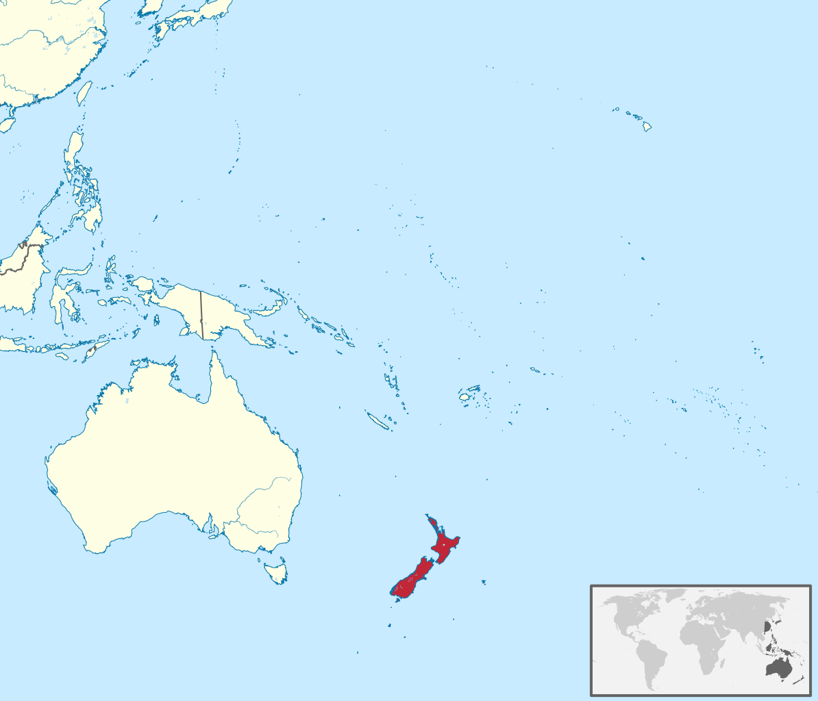
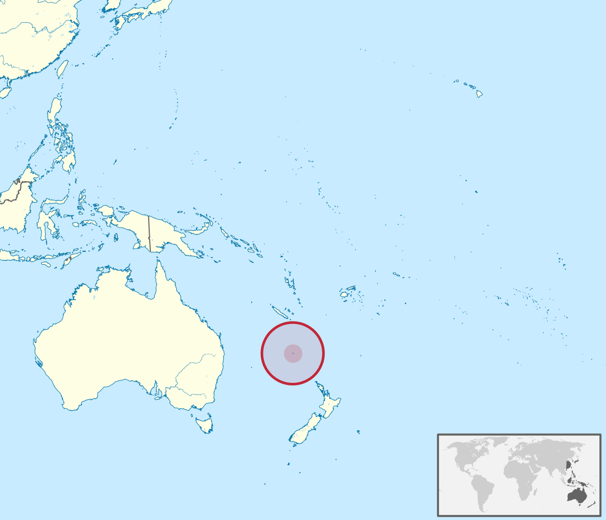
New Zealand (Māori: Aotearoa [aɔˈtɛaɾɔa]) is an island country in the southwestern Pacific Ocean. It consists of two main landmasses—the North Island (Te Ika-a-Māui) and the South Island (Te Waipounamu)—and over 700 smaller islands. It is the sixth-largest island country by area, covering 268,021 square kilometres (103,500 sq mi). New Zealand is about 2,000 kilometres (1,200 mi) east of Australia across the Tasman Sea and 1,000 kilometres (600 mi) south of the islands of New Caledonia, Fiji, and Tonga. The country's varied topography and sharp mountain peaks, including the Southern Alps, owe much to tectonic uplift and volcanic eruptions. New Zealand's capital city is Wellington, and its most populous city is Auckland. The islands of New Zealand were the last large habitable land to be settled by humans. Between about 1280 and 1350, Polynesians began to settle in the islands and then developed a distinctive Māori culture. In 1642, the Dutch explorer Abel Tasman became the first European to sight and record New Zealand. In 1840, representatives of the United Kingdom and Māori chiefs signed the Treaty of Waitangi, which in its English version declared British sovereignty over the islands. In 1841, New Zealand became a colony within the British Empire. Subsequently, a series of conflicts between the colonial government and Māori tribes resulted in the alienation and confiscation of large amounts of Māori land. New Zealand became a dominion in 1907; it gained full statutory independence in 1947, retaining the monarch as head of state. Today, the majority of New Zealand's population of 5.1 million is of European descent; the indigenous Māori are the largest minority, followed by Asians and Pacific Islanders. Reflecting this, New Zealand's culture is mainly derived from Māori and early British settlers, with recent broadening of culture arising from increased immigration. The official languages are English, Māori, and New Zealand Sign Language, with the local dialect of English being dominant. (Source: Wikipedia.org, CC BY-SA)
Niue (/ˈnjuːeɪ/, /niːˈjuːeɪ/; Niuean: Niuē) is an island country in the South Pacific Ocean, 2,400 kilometres (1,500 mi) northeast of New Zealand. Niue's land area is about 261 square kilometres (101 sq mi) and its population, predominantly Polynesian, was about 1,600 in 2016. Niue is located in a triangle between Tonga, Samoa, and the Cook Islands. It is 604 kilometres northeast of Tonga. The island is commonly referred to as 'The Rock', which comes from the traditional name 'Rock of Polynesia'. Niue is one of the world's largest coral islands. The terrain of the island has two noticeable levels. The higher level is made up of a limestone cliff running along the coast, with a plateau in the centre of the island reaching approximately 60 metres (200 feet) above sea level. The lower level is a coastal terrace approximately 0.5 km (0.3 miles) wide and about 25–27 metres (80–90 feet) high, which slopes down and meets the sea in small cliffs. A coral reef surrounds the island, with the only major break in the reef being in the central western coast, close to the capital, Alofi. (Source: Wikipedia.org, CC BY-SA)
Norfolk Island (/ˈnɔːrfək/, locally /ˈnɔːrfoʊk/; Norfuk: Norf'k Ailen) is an external territory of Australia located in the Pacific Ocean between New Zealand and New Caledonia, 1,412 kilometres (877 mi) directly east of Australia's Evans Head and about 900 kilometres (560 mi) from Lord Howe Island. Together with the neighbouring Phillip Island and Nepean Island, the three islands collectively form the Territory of Norfolk Island. At the 2021 census, it had 2188 inhabitants living on a total area of about 35 km2 (14 sq mi). Its capital is Kingston. Norfolk Island is the main island in a group comprising the Australian external territory of Norfolk Island, situated in the Pacific Ocean between Australia and New Zealand approximately 692 km (430 mi) south of New Caledonia. The first known settlers in Norfolk Island were East Polynesians but they had already departed when Great Britain settled it as part of its 1788 settlement of Australia. The island served as a convict penal settlement from 6 March 1788 until 5 May 1855, except for an 11-year hiatus between 15 February 1814 and 6 June 1825, when it lay abandoned. On 8 June 1856, permanent civilian residence on the island began when descendants of the Bounty mutineers were relocated from Pitcairn Island. In 1914 the UK handed Norfolk Island over to Australia to administer as an external territory. Native to the island, the evergreen Norfolk Island pine is a symbol of the island and is pictured on its flag. The pine is a key export for Norfolk Island, being a popular ornamental tree in Australia (where two related species grow), and also worldwide. (Source: Wikipedia.org, CC BY-SA)
The Northern Mariana Islands, officially the Commonwealth of the Northern Mariana Islands (CNMI; Chamorro: Sankattan Siha Na Islas Mariånas; Carolinian: Commonwealth Téél Falúw kka Efáng llól Marianas), is an unincorporated territory and commonwealth of the United States consisting of 14 islands in the northwestern Pacific Ocean. The CNMI includes the 14 northernmost islands in the Mariana Archipelago; the southernmost island, Guam, is a separate U.S. territory. The United States Department of the Interior cites a landmass of 183.5 square miles (475.26 km2). According to the 2020 United States Census, 47,329 people were living in the CNMI at that time. The vast majority of the population resides on Saipan, Tinian, and Rota. The other islands of the Northern Marianas are sparsely inhabited; the most notable among these is Pagan, which for various reasons over the centuries has experienced major population flux, but formerly had residents numbering in the thousands. The administrative center is Capitol Hill, a village in northwestern Saipan. However, most[quantify] publications[which?] consider Saipan to be the capital because the island is governed as a single municipality. (Source: Wikipedia.org, CC BY-SA)
Okinotorishima (沖ノ鳥島, Okinotori-shima), or Parece Vela, is a coral reef with two rocks enlarged with tetrapod-cement structures. It is administered by Japan with a total shoal area of 8,482 m2 (2.10 acres) and land area 9.44 m2 (101.6 sq ft). Its dry land area is mostly made up by three concrete encasings and there is a 100 by 50 m (330 by 160 ft) stilt platform in the lagoon housing a research station. There is a third completely artificial tetrapod-cement islet. It is located on the Palau–Kyushu Ridge in the Philippine Sea, 534 km (332 mi) southeast of Okidaitōjima and 567 km (352 mi) west-southwest of South Iwo Jima in the Bonin Islands or 1,740 km (1,080 mi) south of Tokyo, Japan. The atoll is the southernmost part of Japan and the only Japanese territory south of the Tropic of Cancer. Japan argues that the atoll is significant enough for it to claim a 200 nmi (370 km) exclusive economic zone (EEZ) around it, but China, South Korea, and Taiwan dispute the Japanese EEZ, saying that the atoll does not meet the definition of an island under the United Nations Convention on the Law of the Sea. (Source: Wikipedia.org, CC BY-SA)
Palau, officially the Republic of Palau and historically Belau, Palaos or Pelew, is an island country and microstate in the western Pacific. The nation has approximately 340 islands and connects the western chain of the Caroline Islands with parts of the Federated States of Micronesia. It has a total area of 466 square kilometers (180 sq mi). The most populous island is Koror, home to the country's most populous city of the same name. The capital Ngerulmud is located on the nearby island of Babeldaob, in Melekeok State. Palau shares maritime boundaries with international waters to the north, the Federated States of Micronesia to the east, Indonesia to the south, and the Philippines to the northwest. The country was originally settled approximately 3,000 years ago by migrants from Maritime Southeast Asia. Palau was first drawn on a European map by the Czech missionary Paul Klein based on a description given by a group of Palauans shipwrecked on the Philippine coast on Samar. Palau islands were made part of the Spanish East Indies in 1885. Following Spain's defeat in the Spanish–American War in 1898, the islands were sold to Germany in 1899 under the terms of the German–Spanish Treaty, where they were administered as part of German New Guinea. After World War I, the islands were made a part of the Japanese-ruled South Seas Mandate by the League of Nations. During World War II, skirmishes, including the major Battle of Peleliu, were fought between American and Japanese troops as part of the Mariana and Palau Islands campaign. Along with other Pacific Islands, Palau was made a part of the United States-governed Trust Territory of the Pacific Islands in 1947. Having voted in a referendum against joining the Federated States of Micronesia in 1978, the islands gained full sovereignty in 1994 under a Compact of Free Association with the United States. (Source: Wikipedia.org, CC BY-SA)
Palmyra Atoll (/pælˈmaɪrə/), also referred to as Palmyra Island, is one of the Northern Line Islands (southeast of Kingman Reef and north of Kiribati). It is located almost due south of the Hawaiian Islands, roughly one-third of the way between Hawaii and American Samoa. North America is about 3,300 miles (5,300 kilometers) northeast and New Zealand the same distance southwest, placing the atoll at the approximate center of the Pacific Ocean. The land area is 4.6 sq mi (12 km2), with about 9 miles (14 km) of sea-facing coastline and reef. There is one boat anchorage known as West Lagoon, accessible from the sea by a narrow artificial channel. It is the second-to-northernmost of the Line Islands, and one of three American islands in the archipelago, along with Jarvis Island and Kingman Reef. Palmyra Atoll is part of the Pacific Remote Islands Marine National Monument, the world's largest marine protected area. The atoll is composed of submerged sand flats along with dry land and reefs. It consists of three lagoons separated by coral reefs. The western reef terrace is one of the biggest shelf-reefs, with dimensions of 2 by 3 miles (3.2 by 4.8 km). Over 150 species of coral inhabit Palmyra Atoll, double the number recorded in Hawaii. (Source: Wikipedia.org, CC BY-SA)
Papua New Guinea (abbreviated PNG; /ˈpæp(j)uə ... ˈɡɪni, ˈpɑː-/, also US: /ˈpɑːpwə-, ˈpɑːpjə-, ˈpɑːpə-/; Tok Pisin: Papua Niugini; Hiri Motu: Papua Niu Gini), officially the Independent State of Papua New Guinea (Tok Pisin: Independen Stet bilong Papua Niugini; Hiri Motu: Independen Stet bilong Papua Niu Gini), is a country in Oceania that comprises the eastern half of the island of New Guinea and its offshore islands in Melanesia (a region of the southwestern Pacific Ocean north of Australia). Its capital, located along its southeastern coast, is Port Moresby. The country is the world's third largest island country, with an area of 462,840 km2 (178,700 sq mi). At the national level, after being ruled by three external powers since 1884, including nearly 60 years of Australian administration starting during World War I, Papua New Guinea established its sovereignty in 1975. It became an independent Commonwealth realm in 1975 with Elizabeth II as its queen. It also became a member of the Commonwealth of Nations in its own right. There are 839 known languages of Papua New Guinea, one of the most linguistically diverse countries in the world. As of 2019, it is also the most rural, as only 13.25% of its people live in urban centres. Most of the population of more than 8,000,000 people live in customary communities. The country is believed to be the home of many undocumented species of plants and animals. (Source: Wikipedia.org, CC BY-SA)
The Pitcairn Islands (/ˈpɪtkɛərn/; Pitkern: Pitkern Ailen), officially the Pitcairn, Henderson, Ducie and Oeno Islands, is a group of four volcanic islands in the southern Pacific Ocean that form the sole British Overseas Territory in the Pacific Ocean. The four islands—Pitcairn, Henderson, Ducie and Oeno—are scattered across several hundred miles of ocean and have a combined land area of about 18 square miles (47 km2). Henderson Island accounts for 86% of the land area, but only Pitcairn Island is inhabited. The islands nearest to the Pitcairn Islands are Mangareva (of French Polynesia) at 688 km to the west and Easter Island at 1,929 km to the east. The Pitcairn Islanders are a biracial ethnic group descended mostly from nine Bounty mutineers and a handful of Tahitian consorts—as is still apparent from the surnames of many of the islanders. The mutiny and its aftermath have been the subject of many books and films. As of January 2020, the territory had only 47 permanent inhabitants. (Source: Wikipedia.org, CC BY-SA)
Samoa, officially the Independent State of Samoa and until 1997 known as Western Samoa, is a Polynesian island country consisting of two main islands (Savai'i and Upolu); two smaller, inhabited islands (Manono and Apolima); and several smaller, uninhabited islands, including the Aleipata Islands (Nu'utele, Nu'ulua, Fanuatapu and Namua). Samoa is located 64 km (40 mi) west of American Samoa, 889 km (552 mi) northeast of Tonga (closest foreign country), 1,152 km (716 mi) northeast of Fiji, 483 km (300 mi) east of Wallis and Futuna, 1,151 km (715 mi) southeast of Tuvalu, 519 km (322 mi) south of Tokelau, 4,190 km (2,600 mi) southwest of Hawaii, and 610 km (380 mi) northwest of Niue. The capital city is Apia. The Lapita people discovered and settled the Samoan Islands around 3,500 years ago. They developed a Samoan language and Samoan cultural identity. Samoa is a unitary parliamentary democracy with 11 administrative divisions. It is a sovereign state and a member of the Commonwealth of Nations. Western Samoa was admitted to the United Nations on 15 December 1976. Because of the Samoans' seafaring skills, pre-20th-century European explorers referred to the entire island group (which includes American Samoa) as the 'Navigator Islands'. The country was a colony of the German Empire from 1899 to 1915, then came under a joint British and New Zealand colonial administration until 1 January 1962, when it became independent. (Source: Wikipedia.org, CC BY-SA)
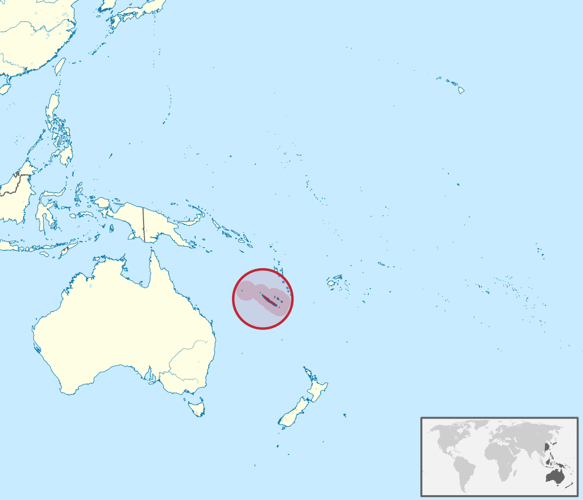
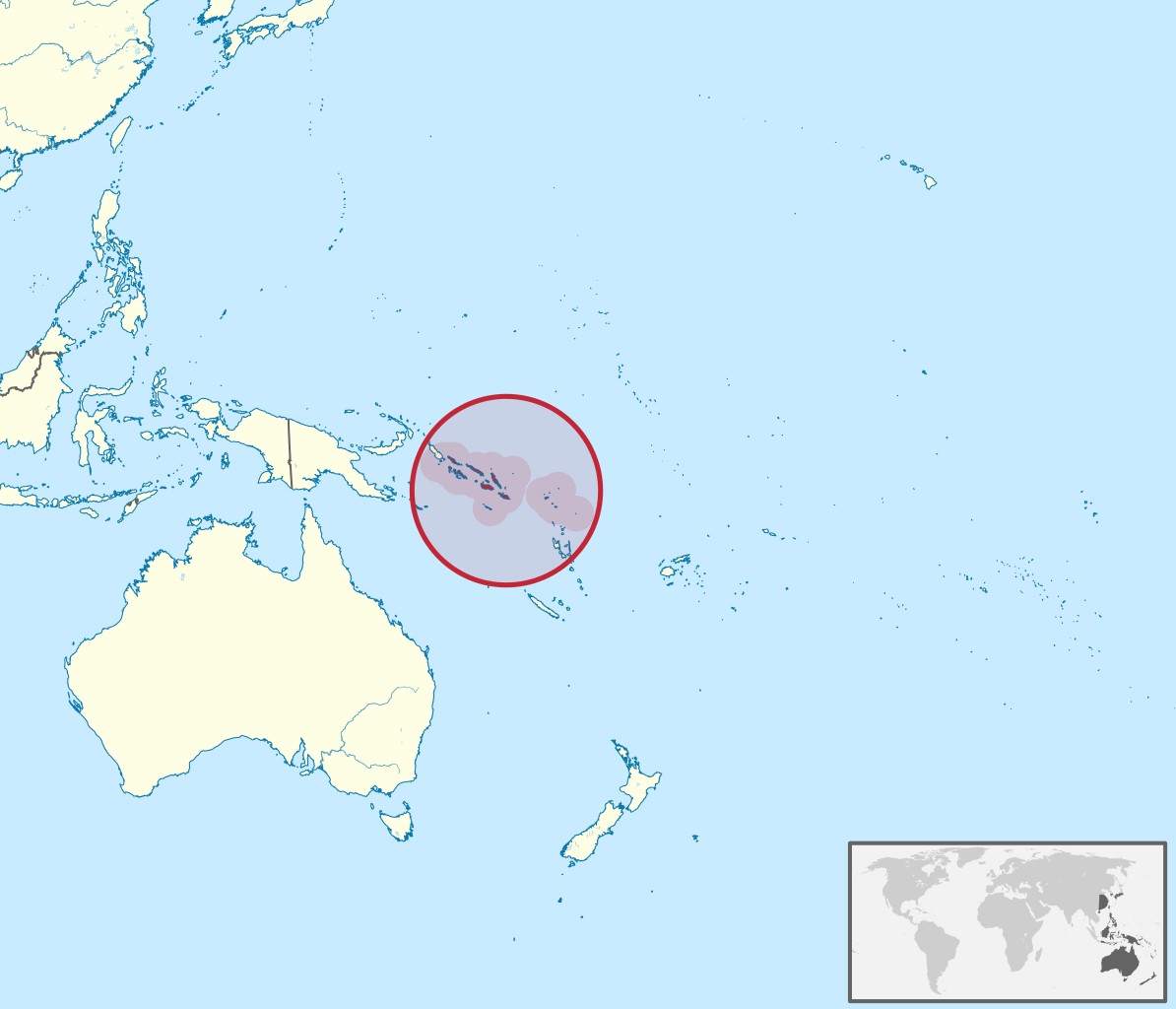
Solomon Islands is an island country consisting of six major islands and over 900 smaller islands in Oceania, to the east of Papua New Guinea and northwest of Vanuatu. It has a land area of 28,400 square kilometres (11,000 sq mi), and a population of about 700,000. Its capital, Honiara, is located on the largest island, Guadalcanal. The country takes its name from the Solomon Islands archipelago, which is a collection of Melanesian islands that also includes the North Solomon Islands (a part of Papua New Guinea), but excludes outlying islands, such as the Santa Cruz Islands and Rennell and Bellona. The islands have been settled since at least some time between 30,000 and 28,800 BCE, with later waves of migrants, notably the Lapita people, mixing and producing the modern indigenous Solomon Islanders population. In 1568, the Spanish navigator Álvaro de Mendaña was the first European to visit them. Though not named by Mendaña, it is believed that the islands were called 'the Solomons' by those who later received word of his voyage and mapped his discovery. Mendaña returned decades later, in 1595, and another Spanish expedition, led by Portuguese navigator Pedro Fernandes de Queirós, visited the Solomons in 1606. Britain defined its area of interest in the Solomon Islands archipelago in June 1893, when Captain Gibson, R.N., of HMS Curacoa, declared the southern Solomon Islands a British protectorate. During World War II, the Solomon Islands campaign (1942–1945) saw fierce fighting between the United States, British Commonwealth forces and the Empire of Japan, including the Battle of Guadalcanal. (Source: Wikipedia.org, CC BY-SA)
Tokelau (/ˈtoʊkəlaʊ/; lit. 'north-northeast' or 'north wind'; known previously as the Union Islands, and, until 1976, known officially as the Tokelau Islands) is a dependent territory of New Zealand in the southern Pacific Ocean. It consists of three tropical coral atolls: Atafu, Nukunonu, and Fakaofo. They have a combined land area of 10 km2 (4 sq mi). The capital rotates yearly among the three atolls. In addition to these three, Swains Island, which forms part of the same archipelago, is the subject of an ongoing territorial dispute; it is currently administered by the United States as part of American Samoa. Tokelau lies north of the Samoan Islands, east of Tuvalu, south of the Phoenix Islands, southwest of the more distant Line Islands, and northwest of the Cook Islands. Tokelau has a population of approximately 1,500 people; it has the fourth-smallest population of any sovereign state or dependency in the world. As of the 2016 census, around 45% of its residents had been born overseas, mostly in Samoa or New Zealand. The populace has a life expectancy of 69, which is comparable to that of other Oceanian island nations. Approximately 94% of the population speak Tokelauan as their first language. Tokelau has the smallest economy of any sovereign nation, although it is a leader in renewable energy, being the first 100% solar-powered nation in the world. (Source: Wikipedia.org, CC BY-SA)
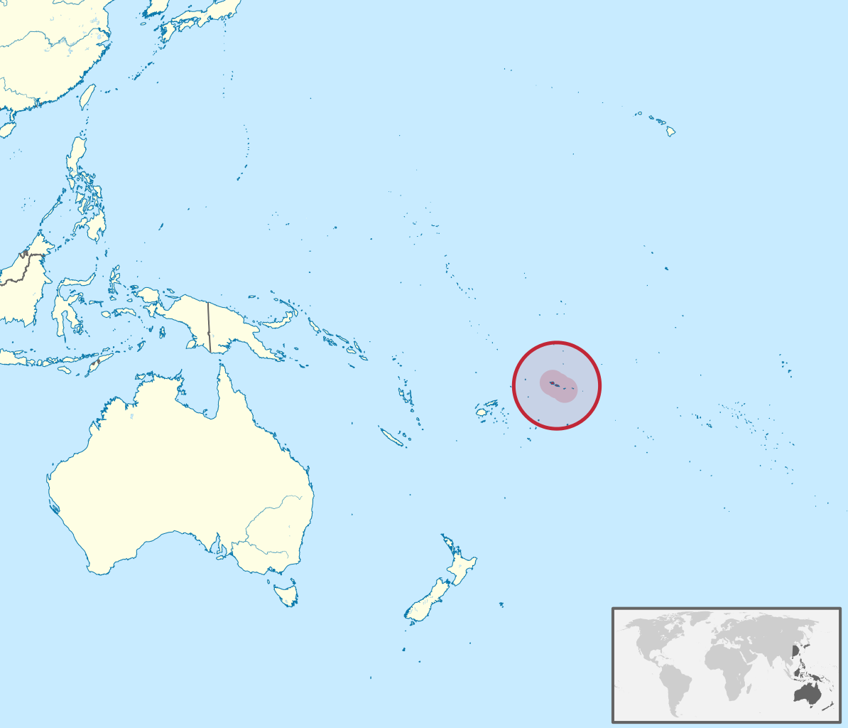
Tonga (/ˈtɒŋɡə/, /ˈtɒŋə/; Tongan: [ˈtoŋa]), officially the Kingdom of Tonga (Tongan: Puleʻanga Fakatuʻi ʻo Tonga), is a Polynesian country and archipelago. The country has 171 islands – of which 45 are inhabited. Its total surface area is about 750 km2 (290 sq mi), scattered over 700,000 km2 (270,000 sq mi) in the southern Pacific Ocean. As of 2021, according to Johnson's Tribune, Tonga has a population of 104,494, 70% of whom reside on the main island, Tongatapu. The country stretches approximately 800 km (500 mi) north-south. It is surrounded by Fiji and Wallis and Futuna (France) to the northwest; Samoa to the northeast; New Caledonia (France) and Vanuatu to the west; Niue (the nearest foreign territory) to the east; and Kermadec (New Zealand) to the southwest. Tonga is about 1,800 km (1,100 mi) from New Zealand's North Island. First inhabited roughly 2,500 years ago by the Lapita civilization, Tonga's Polynesian settlers gradually evolved a distinct and strong ethnic identity, language, and culture as the Tongan people. They were quick to establish a powerful footing across the South Pacific, and this period of Tongan expansionism and colonization is known as the Tuʻi Tonga Empire. From the rule of the first Tongan king, ʻAhoʻeitu, Tonga grew into a regional power. It was a thalassocracy that conquered and controlled unprecedented swathes of the Pacific, from parts of the Solomon Islands and the whole of New Caledonia and Fiji in the west to Samoa and Niue and even as far as parts of modern-day French Polynesia in the east. Tuʻi Tonga became renowned for its economic, ethnic, and cultural influence over the Pacific, which remained strong even after the Samoan revolution of the 13th century and Europeans' discovery of the islands in 1616. (Source: Wikipedia.org, CC BY-SA)
Tuvalu (/tuːˈvɑːluː/ too-VAH-loo or /ˈtuːvəluː/ TOO-və-loo; formerly known as the Ellice Islands) is an island country and microstate in the Polynesian subregion of Oceania in the Pacific Ocean. Its islands are situated about midway between Hawaii and Australia. They lie east-northeast of the Santa Cruz Islands (which belong to the Solomon Islands), northeast of Vanuatu, southeast of Nauru, south of Kiribati, west of Tokelau, northwest of Samoa and Wallis and Futuna, and north of Fiji. Tuvalu is composed of three reef islands and six atolls. They are spread out between the latitude of 5° and 10° south and between the longitude of 176° and 180°. They lie west of the International Date Line. Tuvalu has a population of 10,507 (2017 census). The total land area of the islands of Tuvalu is 26 square kilometres (10 sq mi). The first inhabitants of Tuvalu were Polynesians, according to well-established theories regarding a migration of Polynesians into the Pacific that began about three thousand years ago. Long before European contact with the Pacific islands, Polynesians frequently voyaged by canoe between the islands. Polynesian navigation skills enabled them to make elaborately planned journeys in either double-hulled sailing canoes or outrigger canoes. Scholars believe that the Polynesians spread out from Samoa and Tonga into the Tuvaluan atolls, which then served as a stepping stone for further migration into the Polynesian outliers in Melanesia and Micronesia. (Source: Wikipedia.org, CC BY-SA)
Vanuatu (English: /ˌvɑːnuˈɑːtuː/ VAH-noo-AH-too or /vænˈwɑːtuː/ van-WAH-too; Bislama and French pronunciation [vanuatu]), officially the Republic of Vanuatu (French: République de Vanuatu; Bislama: Ripablik blong Vanuatu), is an island country located in the South Pacific Ocean. The archipelago, which is of volcanic origin, is 1,750 km (1,090 mi) east of northern Australia, 540 km (340 mi) northeast of New Caledonia, east of New Guinea, southeast of the Solomon Islands, and west of Fiji. Vanuatu was first inhabited by Melanesian people. The first Europeans to visit the islands were a Spanish expedition led by Portuguese navigator Fernandes de Queirós, who arrived on the largest island, Espíritu Santo, in 1606. Queirós claimed the archipelago for Spain, as part of the colonial Spanish East Indies, and named it La Austrialia del Espíritu Santo. In the 1880s, France and the United Kingdom claimed parts of the archipelago, and in 1906, they agreed on a framework for jointly managing the archipelago as the New Hebrides through an Anglo-French condominium. An independence movement arose in the 1970s, and the Republic of Vanuatu was founded in 1980. Since independence, the country has become a member of the United Nations, Commonwealth of Nations, Organisation internationale de la Francophonie and the Pacific Islands Forum. (Source: Wikipedia.org, CC BY-SA)
Wake Island (Marshallese: Ānen Kio, lit. 'island of the kio flower'; also known as Wake Atoll) is a coral atoll in the western Pacific Ocean in the northeastern area of the Micronesia subregion, 1,501 miles (2,416 kilometers) east of Guam, 2,298 miles (3,698 kilometers) west of Honolulu, 1,991 miles (3,204 kilometers) southeast of Tokyo and 898 miles (1,445 kilometers) north of Majuro. The island is an unorganized, unincorporated territory belonging to (but not a part of) the United States that is also claimed by the Republic of the Marshall Islands. Wake Island is one of the most isolated islands in the world. The nearest inhabited island is Utirik Atoll in the Marshall Islands, 592 miles (953 kilometers) to the southeast. The United States took possession of Wake Island in 1899. One of 14 U.S. insular areas, Wake Island is administered by the United States Air Force under an agreement with the U.S. Department of the Interior. The center of activity on the atoll is at Wake Island Airfield, which is primarily used as a mid-Pacific refueling stop for military aircraft and as an emergency landing area. The 9,800-foot (3,000 m) runway is the longest strategic runway in the Pacific islands. South of the runway is the Wake Island Launch Center, a missile launch site. The island has no permanent inhabitants, but approximately 100 people live there at any given time. (Source: Wikipedia.org, CC BY-SA)
Wallis and Futuna, officially the Territory of the Wallis and Futuna Islands (/ˈwɒlɪs ... fuːˈtuːnə/; French: Wallis-et-Futuna [walis e futuna] or Territoire des îles Wallis-et-Futuna, Fakauvea and Fakafutuna: ʻUvea mo Futuna), is a French island collectivity in the South Pacific, situated between Tuvalu to the northwest, Fiji to the southwest, Tonga to the southeast, Samoa to the east, and Tokelau to the northeast. Mata Utu is its capital and largest city. Its land area is 142.42 km2 (54.99 sq mi). It had a population of 11,558 at the 2018 census (down from 14,944 at the 2003 census). The territory is made up of three main volcanic tropical islands and a number of tiny islets. It is divided into two island groups that lie about 260 km (160 mi) apart: the Wallis Islands (also known as Uvea) in the northeast; and the Hoorn Islands (also known as the Futuna Islands) in the southwest, including Futuna Island proper and the mostly uninhabited Alofi Island. Since 28 March 2003, Wallis and Futuna has been a French overseas collectivity (collectivité d'outre-mer, or COM). Between 1961 and 2003, it had the status of a French overseas territory (territoire d'outre-mer, or TOM). Its official name did not change when its status changed. (Source: Wikipedia.org, CC BY-SA)

Time for recess! Post a comment, ask a question or write a review. Feel free to let us know what you think!
Some terms were different than my study book, and I found that confusing. Also the car alert signs were something I had not studied at all, good to learn something new.
 -1
-1
Below are wonderful knowledge resources for foreigners willing to Drive in Malaysia: Driving in Malaysia: What Foreign National Drivers Should Know? https://driveinmalaysia.com/blog/2022/driving-in-malaysia-what-foreign-national-drivers-should-know/ What Foreign Students in Malaysia Should Know about Driving Licence and its Conversion? https://driveinmalaysia.com/blog/2024/guide-on-malaysian-driving-license-and-its-conversion-for-foreign-students/
when you have a wrong answer the next will be counted wrong too no matter if it's right. This could leed to confusion.
0
Amazing website with all basic Rules .Much more appreciated and my sincere gratitude .
1
81/85 as an Italian who never drove in US, wonder if that's enough to pass the licence test there?
17
look at the sign on the road to avoid accidents and horrible driving conditions
-4


More community